
Introduction
The Poudre Canyon is a stunningly beautiful and ecologically rich area that has captivated visitors for centuries. This guide will introduce you to the fascinating natural history of the Poudre Canyon, from its geology and climate to its wildlife and plant communities. If you’re interested in learning more, inquire about our guided natural history tours.
Geology
Colorado's geology is characterized by a diverse array of rock formations and landforms. Factors such as tectonic history and climate contribute to this diversity, shaping the landscape. Mineral resources, such as gold, silver, and copper have played a significant role in the state's economy and history. Poudre Canyon lies north of the main mineralized belt producing precious metal finds in the state, but the search for gold still played an important part in the Canyon’s history.
Rock Types
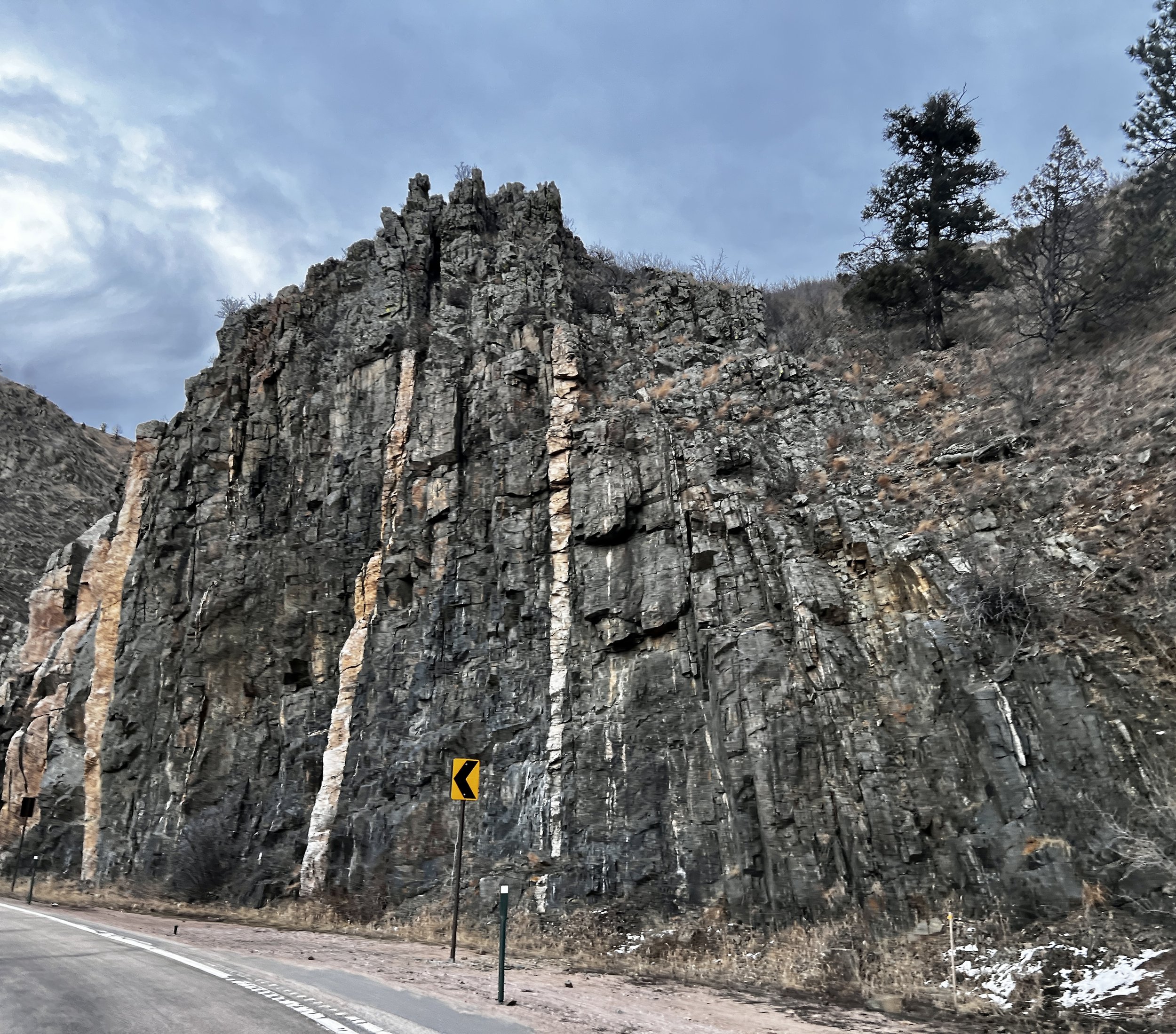
Granite is an igneous rock formed from cooled magma and composed of minerals like quartz, feldspar, and mica. Granite batholiths are large rock formations created when magma intrudes into surrounding layers, cools, and solidifies. They often contain valuable minerals. Many of the prominent landforms in the Canyon and Red Feather Lakes area are exposed portions of batholiths. Contact metamorphism occurs when rocks are altered due to high temperatures and pressures from contact with magma. Gneiss, a metamorphic rock, forms under such conditions and contains minerals like quartz, feldspar, and mica and is common in the Canyon.
The geology of the area provides a comprehensive record of the region's geological history. Proterozoic basement rocks in the core of the range document Paleoproterozoic marine sedimentation, volcanism, regional soft-sediment deformation, and metamorphism. The Routt Plutonic Suite's intrusion occurred concurrently with widespread metamorphism. In Mesoproterozoic time, the Berthoud Plutonic Suite intruded into the crust, and mylonite zones, such as the Skin Gulch shear zone, were formed producing spectacular well-foliated and deformed rocks.
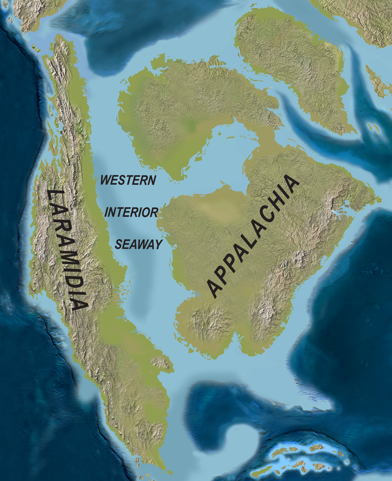
The late Paleozoic Anasazi uplift (i.e. Ancestral Rocky Mountains uplift) is recorded in the area by the removal of Permian and older sediments and deposition of Pennsylvanian and Permian strata on exposed Proterozoic basement rocks. Throughout the Mesozoic Era, Phanerozoic sediments suggest a steady progression of fluvial, eolian, and lacustrine environments. The Cretaceous Western Interior Seaway, a shallow marine embayment, persisted during the latter part of the Mesozoic Era. Beautiful examples of these formations occur in Lory State Park and throughout the mountain front along the Front Range. The Laramide orogeny in the late Cretaceous period led to mountain building and deformation, placing Proterozoic rock over Cretaceous and Paleocene strata along the western margin of the Front Range and Medicine Bow Mountains.
Post-Laramide time was marked by prolonged weathering, erosion, and planation of the basement rock surface. White River Group's tuffaceous fluvial sediments record the early part of Cenozoic geologic history across the area. Volcanic activity in the Never Summer Mountains during middle Oligocene time led to basaltic, dacitic, and rhyolitic lava and welded tuff eruptions. The upper Oligocene to Miocene North Park Formation contains clasts of this volcanic material, documenting erosion and fluvial deposition from the volcanic highland. The Miocene Ogallala Formation fluvial apron developed as the mountainous highlands degraded, and renewed uplift during Pliocene time caused rapid incision of meandering streams into Proterozoic basement rocks, producing the entrenched meanders characteristic of major east-flowing streams west of the mountain front today.
Colluvium is a sedimentary deposit formed by the accumulation of material transported and deposited by gravity and deposits are widespread in the Canyon. It is typically found at the base of slopes, hillsides, and other steep terrains, and is composed of a mixture of materials, including rock fragments, sand, silt, clay, and organic matter. Alluvium, on the other hand, is a sedimentary deposit formed by the accumulation of material transported and deposited by flowing water. It is typically found in riverbeds, floodplains, and low-lying areas subject to periodic flooding. Like colluvium, alluvium is composed of a mixture of materials, including rock fragments, sand, silt, clay, and organic matter. Alluvium is important in geomorphology, influencing the shape and stability of river channels and floodplains, and providing valuable information about an area's geologic history.
The glacial history of the Front Range is characterized by multiple periods of glaciation and deglaciation over the past several million years. These glacial episodes have played a significant role in shaping the landscape, carving out valleys, and depositing moraines and glacial sediments throughout the region.
During the Pleistocene Epoch, which lasted from around 2.6 million to 11,700 years ago, the Front Range experienced several major glacial advances and retreats. The most extensive glaciations occurred during the Bull Lake and Pinedale glaciations. During these periods, large alpine glaciers descended from the high peaks of the Front Range, carving out U-shaped valleys and leaving behind moraines, which are ridges of glacial debris that mark the glacier's former extent. The last major glacial event, known as the Pinedale glaciation, took place around 30,000 to 10,000 years ago. This glaciation left a significant impact on the landscape, with some of the most prominent glacial features, such as moraines and glacial lakes, dating back to this period. As the climate warmed during the Holocene Epoch, which began around 11,700 years ago, the glaciers retreated, leaving behind a landscape marked by their erosional and depositional processes.
Landslide and debris flow deposits were significantly active from the late Pleistocene to Holocene across the mountainous regions. Erosion persists in the High Plains situated east of the mountain front. The ongoing incision of the drainage system is evident in at least five major gravel-covered terrace and pediment surfaces along the primary fluvial channels connected to the South Platte River system.
A geological tour of the Canyon…
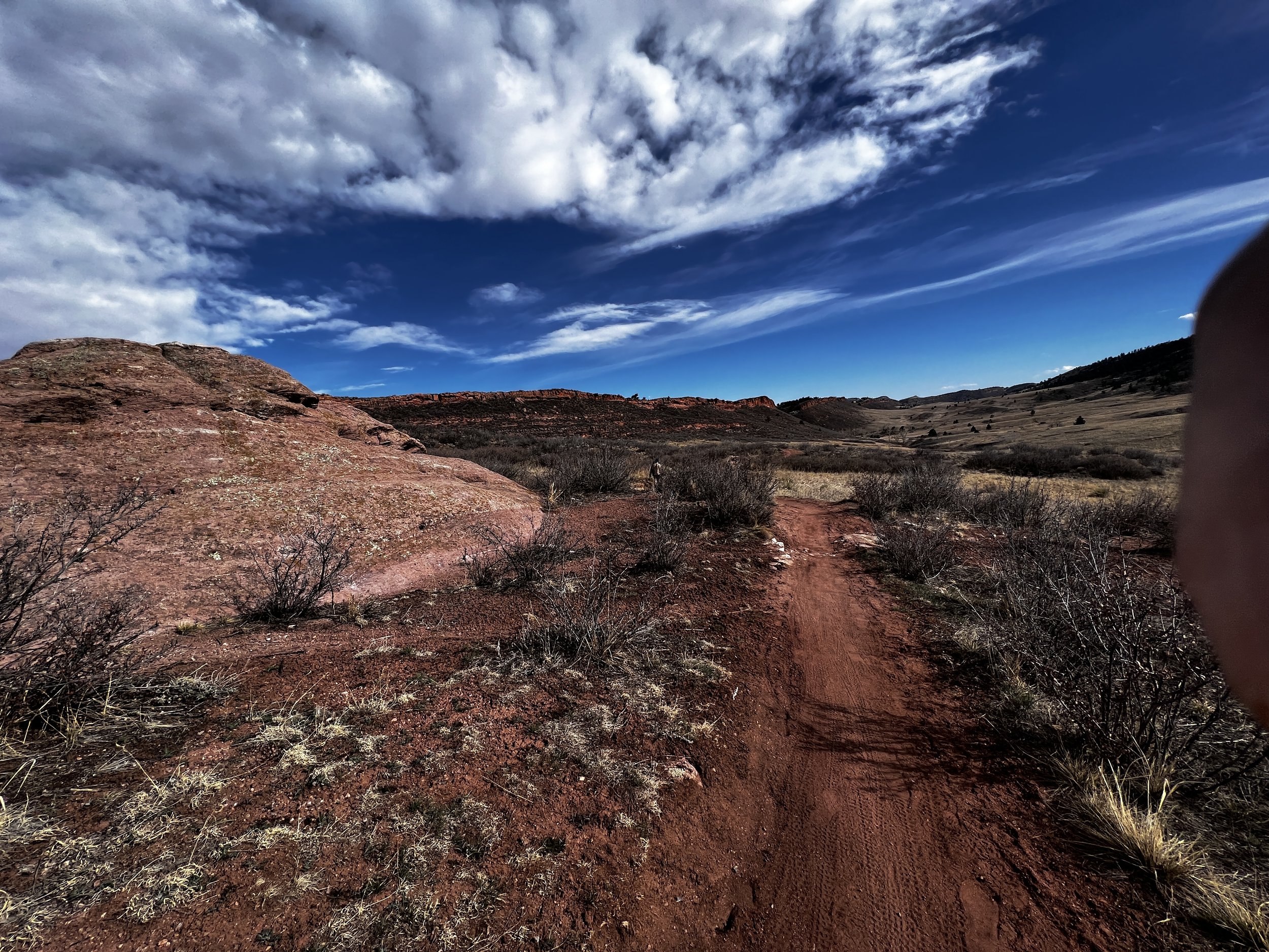
Teds Place, at the mouth of the Poudre Canyon, is located in a valley between the Cretaceous Dakota Formation and the Precambrian metamorphic rocks of the Front Range. The lower Cache la Poudre River canyon is unglaciated with a "V-shape," while the upper reaches have been glaciated, creating a "U-shaped" section.
Cameron Pass and its surroundings have an impressive section of Mesozoic rocks exposed along the Never Summer Thrust Fault. The Pierre Shale, a Cretaceous rock unit, is exposed at high elevations and as a metamorphic rock called hornfel in the Nokhu Crags-Mt. Richthofen area. During the Laramide Orogeny, the Never Summer Range was uplifted, faulted, and eroded, with Precambrian rocks moving westward over the sedimentary section. Volcanism began around 32 million years ago, and around 29 million years ago, the granodiorite and monzonite stock of Mt. Richthofen was emplaced, providing heat to transform the shale into hornfel. Uplift, erosion, and glaciation have shaped the area's dramatic landscape, making it an ideal location to observe fascinating geology.
Topography significantly impacts the microclimate in mountainous areas, affecting solar radiation, air mass movement, weather patterns, and elevation. South-facing slopes receive more direct sunlight, leading to warmer and drier conditions, while north-facing slopes are cooler and moister. Mountain ranges can create local weather patterns, and increasing elevation results in colder, drier air and more extreme microclimates.
The topography of the canyon influences plant distribution, as slope orientation and sunlight exposure determine which plants can thrive in specific locations. Topographic characteristics also affect wildfire behavior, as land shape, slope, and fuel availability influence fire spread and containment difficulty. Understanding topography is crucial for predicting and managing wildfire risk.
Current Climate
The Canyon’s climate is heavily influenced by its location along the eastern slope of the Rocky Mountains, within the continent’s interior. The high elevation and complex terrain result in significant variations in temperature, precipitation, and wind patterns within a relatively small geographic area. The region experiences a continental climate with cold winters and warm summers, and the high elevation can contribute to rapid weather changes.
During warm El Niño events in the U.S., the mid-latitude winter storm track is typically situated further south than in non-El Niño years. This causes greater amounts of precipitation and often warmer temperatures in the region. In the Rocky Mountain region, from Idaho to southern Colorado, there are weak but significant correlations between snowpack and ENSO activity. In Colorado, spring precipitation is generally above average during El Niño events and below average during La Niña events.
The climate of northern Colorado is also influenced by the warming and cooling of the northern Pacific Ocean at decadal time scales. This oscillation, known as the Pacific Decadal Oscillation (PDO), impacts the climate of a vast area of western North America. Drought in Colorado is associated with the negative, or cool, phase of the PDO. The PDO experienced only two full cycles during the 20th century, and future reversals of the PDO phase could lead to climate changes in the western U.S. that are beyond recent memory.
Apart from the PDO, multi-decadal oscillations of sea surface temperatures from the northern Atlantic also significantly affect the climate. These fluctuations, consisting of cool and warm phases spanning 20 to 30 years, play a considerable role in shaping regional climate patterns.
Historical Climate
Fossil insect evidence suggests that during the late glacial maximum (LGM), around 24,000 to 18,000 years ago, mean July temperatures in the southern Rockies were 9 to 10°C cooler than today. Modern summer temperatures were reached approximately 12,000 years ago, with warmer than current temperatures prevailing between 10,000 and 3,500 years ago. Fossil pollen evidence indicates that alpine treelines in the Southern Rockies were about 300 meters higher than they are now during the period from 9,000 to 4,500 years ago. Temperature fluctuations were accompanied by changes in precipitation, with generally wetter conditions during warmer periods and drier conditions during colder periods. These shifts in climate led to significant changes in vegetation patterns in the Colorado Rockies.
During the LGM, limber pine was a dominant component of montane forests across much of the western US, which is in contrast to its often restricted range today. In the same period, the occurrence of ponderosa pine was limited, seemingly confined to a few mountain ranges in southern Arizona and Mexico. As the glacial period came to an end, the dominance of species like ponderosa pine increased.
Vegetation
As you ascend in elevation in the Canyon, you will encounter different vegetation types, each characterized by unique plant species and ecological conditions. The following general vegetation types are typically encountered in a bottom-to-top sequence as you move through the elevation gradient:
Foothills Shrublands and Woodlands: At lower elevations (5,000 to 6,500 feet), the landscape is dominated by shrublands and woodlands, featuring grasses, sagebrush, and mountain mahogany. Ponderosa pine is the most common tree species in this zone, forming open forests or mixed with shrubs.
Montane Forest: As you move higher in elevation (6,500 to 9,000 feet), the montane forest zone becomes dominant. Ponderosa pines continue to be present, accompanied by Douglas-fir, lodgepole pine, and aspen trees. The understory consists of various shrubs, grasses, and wildflowers.
Subalpine Forest: In the elevation range of 9,000 to 11,500 feet, the subalpine forest zone emerges. This zone is characterized by dense stands of Engelmann spruce and subalpine fir, with some areas of aspen and lodgepole pine. The understory is composed of shrubs, grasses, and alpine wildflowers, with the forest floor often covered in thick layers of moss and lichen.
Alpine Tundra: Above the treeline, which typically occurs around 11,500 feet, the alpine tundra zone dominates. Trees are sparse or absent in this zone, as the harsh weather conditions and short growing season make it difficult for most trees to survive. Instead, the landscape is characterized by low-growing plants, such as grasses, sedges, cushion plants, and alpine wildflowers, which are adapted to the extreme conditions.
Boundaries between these general community types are not crisp and vary due to local environmental factors like terrain aspect and soil type.
Trees
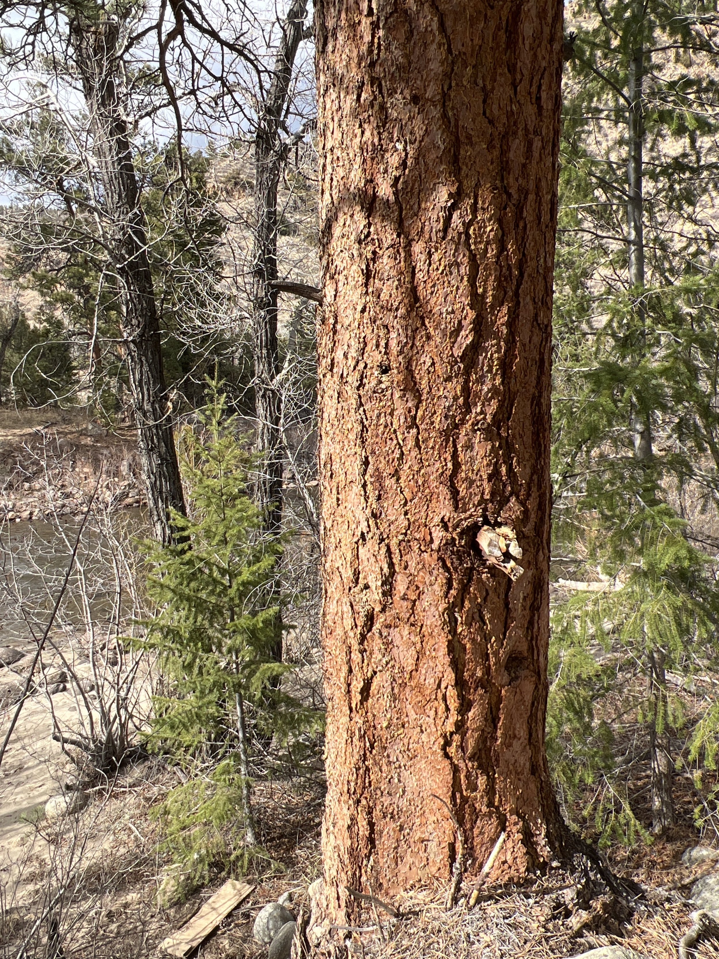
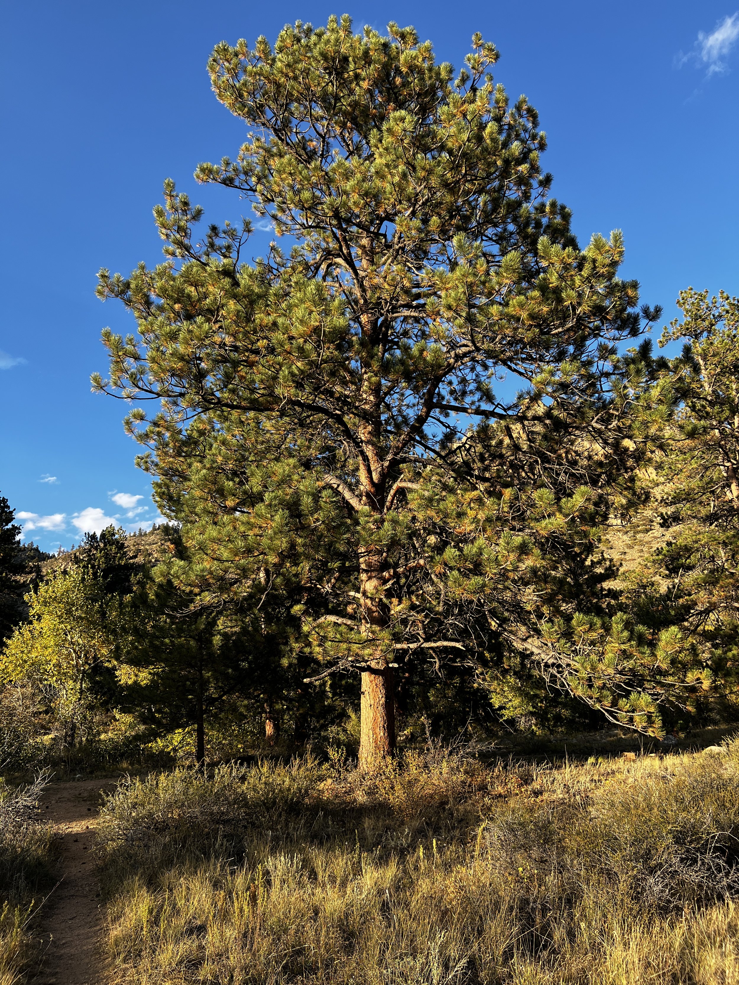
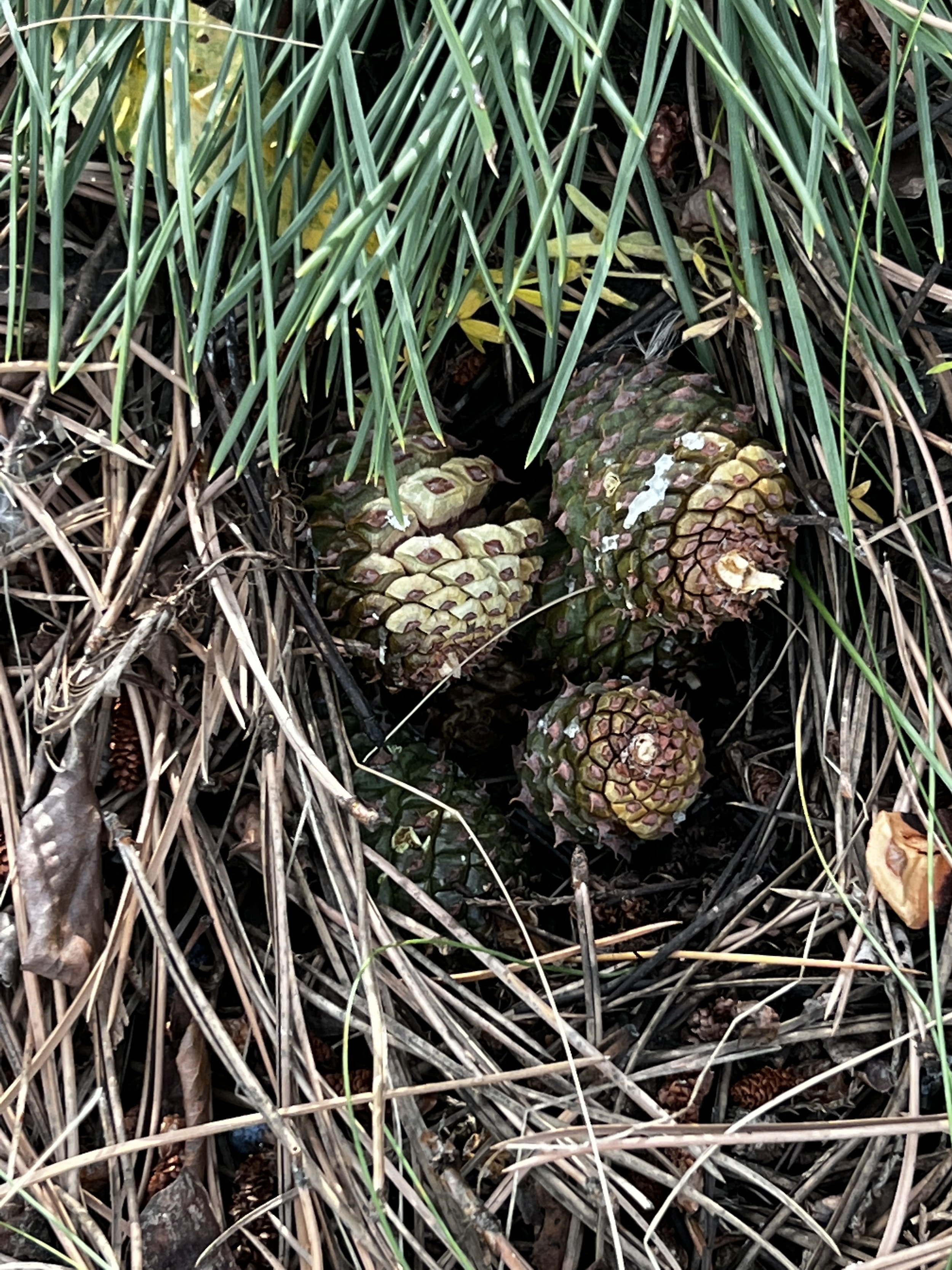
At lower elevations, the dominant tree species is the Ponderosa Pine (Pinus ponderosa), a member of the family Pinaceae. Ponderosa Pines are long-lived, with a lifespan of up to 600 years, and can reach heights of 60 to 100 feet. These trees are adapted to fire-prone environments, with thick, fire-resistant bark and deep taproots. Their needles are bundled in fascicles of two or three, and they produce large, woody cones. Ponderosa Pines are also characterized by their yellow to reddish-brown bark, which gives off a pleasant, vanilla-like scent in warm weather.
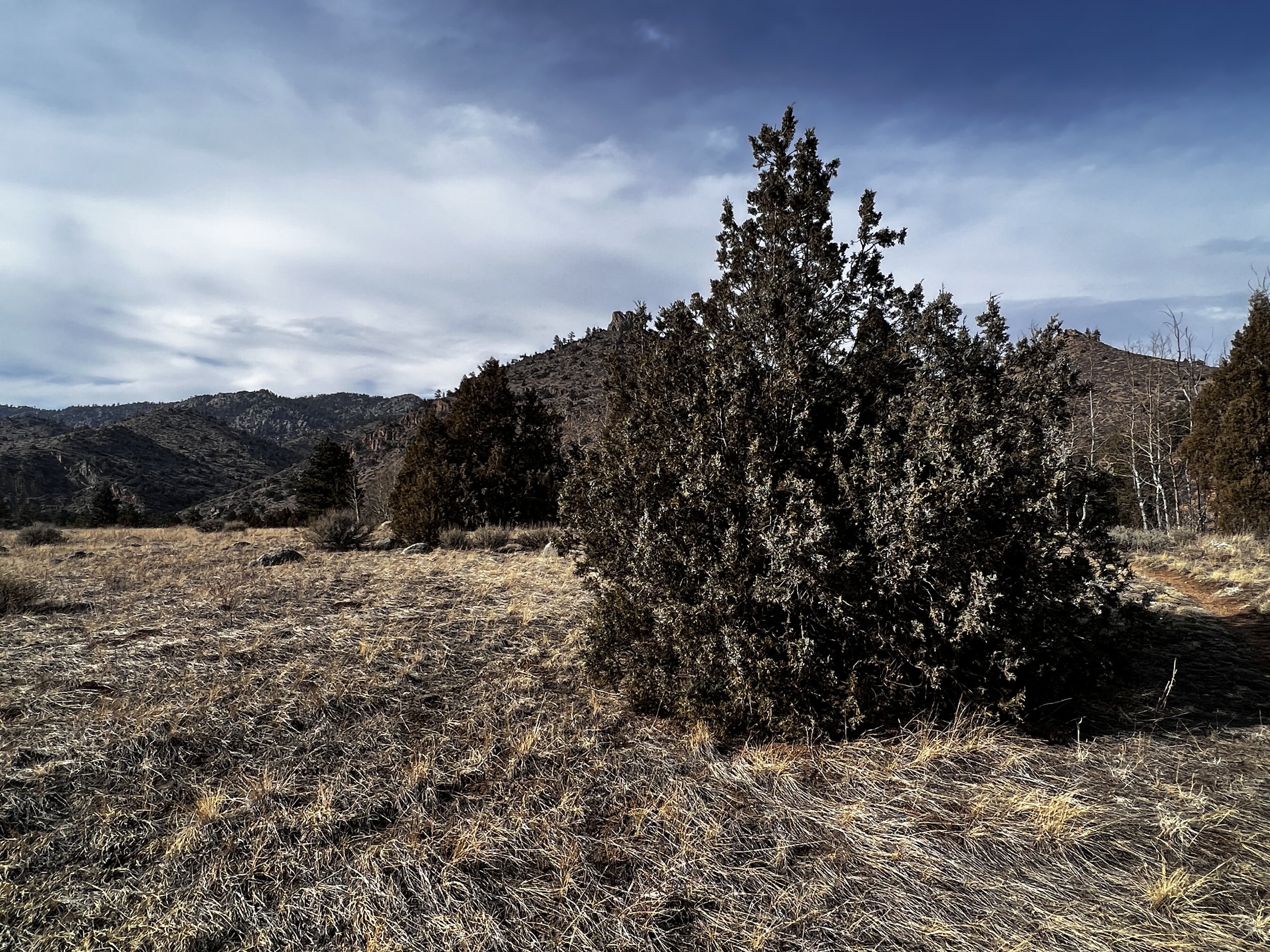
Rocky Mountain Juniper (Juniperus scopulorum) is another common tree species found in the Canyon. This species is a member of the Cupressaceae family and can be found at elevations ranging from 5,000 to 9,000 feet. Rocky Mountain Junipers often grow in mixed stands with Ponderosa Pines or in areas with rocky, well-drained soils. Trees are small to medium-sized and evergreen, typically reaching heights of 30 to 40 feet and with a lifespan of up to 400 years. The foliage of this species is comprised of scale-like leaves that are tightly pressed against the branches and are grayish-green in color. The leaves give off a characteristic aromatic scent when crushed. Rocky Mountain Junipers are dioecious, with male and female cones produced on separate trees. The female cones resemble small, fleshy, bluish-black berries, which contain one to three seeds and are consumed by various bird species. The male cones are small and inconspicuous, producing pollen that is dispersed by the wind.
The bark of Rocky Mountain Junipers is thin, fibrous, and peeling, with a reddish-brown color. The trunks of these trees are often twisted or contorted, giving them a distinct, rugged appearance. Their growth habit can vary from shrub-like in harsh environments to more tree-like forms in more favorable conditions. Rocky Mountain Junipers are well-adapted to the semi-arid conditions of the Front Range, with their drought-tolerant characteristics and ability to grow in nutrient-poor soils.
Rocky Mountain Juniper is notably prevalent on south-facing slopes in the Poudre Canyon, which receive more sunlight and tend to have warmer, drier conditions compared to north-facing slopes. These conditions favor the growth of drought-tolerant species like the Rocky Mountain Juniper, which can thrive in well-drained, rocky soils with limited moisture. The trees provide valuable habitat for various wildlife species and contribute to the overall ecological diversity and aesthetic beauty of the canyon at low to middle elevations.
Douglas Fir (Pseudotsuga menziesii), a coniferous and evergreen member of the Pinaceae family, is another important tree species found in the Poudre Canyon. Found at elevations ranging from 6,000 to 9,500 feet, it is particularly prevalent on north-facing slopes and also occurs in lodgepole pine habitat types that have been fire protected. Open-growing trees often have branches over the length of the bole, while lower limbs in trees in dense stands are commonly absent. Douglas fir saplings have smooth and photosynthetically active bark covered with resin blisters. In contrast, mature individuals have thick and deeply-furrowed bark. Mature trees can reach 100 to 130 feet (30 to 42 m) high. Needles are range from 0.6 to 1.4 inches (15-35 mm) long, much shorter than co-occurring pines like the Poderosa.
Mature cones are 1.6 to 2.8 inches (4 to 7 cm) long and are easily identified by the “mouse tail” appearing between cone scales. A Native American legend tells of a large forest fire with animals running frantically trying to escape the flames. Mice, not fast enough to outrun the fire, sought shelter in various trees. Denied in their request for shelter from other trees, the mice approached the noble Douglas fir tree and asked if they could hide amongst its branches. The Douglas fir agreed and allowed them to shelter in its cones.
Lodgepole Pine (Pinus contorta) is another important tree species in the Front Range, belonging to the Pinaceae family. Found at elevations between 6,000 and 11,000 feet, Lodgepole Pines are are adapted to fire-prone environments and have serotinous cones that require high temperatures to open and release seeds. Lodgepole Pine needles are bundled in fascicles of two, and they are dark green, slender, and twisted. The bark of Lodgepole Pines is thin and flaky, with a reddish-brown to gray color. Lodgepole Pines often form dense, monospecific stands, which can be seen in areas recovering from fire or other disturbances.
As one ascends in elevation, Engelmann Spruce (Picea engelmannii) becomes more prevalent. This species, also a member of the Pinaceae family, can be found between 9,000 and 11,500 feet in elevation. The needles of this species are short, stiff, and sharp, with a square cross-section. The cones produced by Engelmann Spruce are relatively small and light, with thin, flexible scales. Engelmann Spruces can be identified by their grayish-brown bark, which often has a scaly, flaky texture.
In the subalpine zone, typically between 9,000 and 11,500 feet in elevation, Subalpine Fir (Abies lasiocarpa) is another dominant tree species. This species belongs to the family Pinaceae, and it is well-adapted to the harsh conditions at these elevations. The needles are flat and blunt-tipped, with a blue-green color, and they are arranged in a spiral pattern on the branches. The cones are upright and cylindrical, with scales that disintegrate at maturity to release the seeds. The bark of young Subalpine Firs is smooth and silvery-gray, while older trees have rough, grayish-brown bark with resin blisters.
At various elevations, particularly in disturbed or transitional areas, Quaking Aspen (Populus tremuloides) can be found. This species is a member of the family Salicaceae and is widely distributed across North America. Quaking Aspens are typically found between 6,500 and 11,500 feet in elevation. These trees grow in clonal groves, with a shared root system, and are relatively short-lived, with a lifespan of 40 to 150 years. Quaking Aspens can reach heights of 30 to 80 feet, and they are characterized by their smooth, pale bark and nearly circular leaves with finely serrated margins. The leaves are attached to the branches by flattened petioles, which cause the leaves to tremble in the wind, hence the name "Quaking" Aspen.
Colorado Blue Spruce (Picea pungens), a member of the Pinaceae family, is native to the Rocky Mountains and is the state tree of Colorado. Found at elevations between 6,000 and 10,000 feet, these trees can reach heights of 100 to 150 feet and have a lifespan of up to 600 years. Colorado Blue Spruce trees are known for their striking blue-green needles, which are sharp, stiff, and roughly 1 inch long. The cones of this species are medium-sized, with thin, flexible scales. The bark is grayish-brown and scaly, sometimes appearing furrowed on older trees. Colorado Blue Spruce trees are commonly used as ornamental trees due to their attractive color and symmetrical form.
Blue spruce is a species of the montane zone in the central and southern Rocky Mountains, where it occurs as a dominant in some areas or as a minor associate in Engelmann Spruce-Subalpine Fir and Cottonwood-Willow cover types. Blue spruce is seldom found in large numbers, but on riparian sites it is often the only coniferous species present amongst hardwoods like narrowleaf cottonwood (Populus angustifolia), and quaking aspen. Smaller streamside trees and common shrub associates are water birch (Betula occidentalis), mountain alder (Alnus tenuifolia), shrubby cinquefoil (Potentilla fruticosa), western snowberry (Symphoricarpos albus), chokecherry (Prunus virginiana), and various species of willow (Salix). On north-facing slopes, blue spruceare generally restricted to drainage bottoms, mixed with Douglas-fir or lodgepole pine, while at higher elevations, it may occur with Engelmann spruce, subalpine fir, and quaking aspen on moist sites, or lodgepole pine on drier sites.
Narrowleaf Cottonwood (Populus angustifolia), is a member of the Salicaceae family, along with aspen and willows. This species is found along riparian corridors and moist habitats at elevations ranging from 4,500 to 9,000 feet. Narrowleaf Cottonwoods are deciduous trees with a typical height of 40 to 60 feet and a lifespan of around 100 years. The leaves of this species are lanceolate, with finely serrated margins, and they turn a brilliant yellow in the fall. The bark of young trees is smooth and greenish-gray, while older trees have thick, deeply furrowed bark. The tree is dioecious, meaning that male and female flowers are borne on separate trees, and the seeds are dispersed by cottony tufts that can be carried by the wind.
| Common Name | Scientific Name | Ecology |
|---|---|---|
| Blue Spruce | Picea pungens | Native coniferous tree, grows near water sources and in moist, cool environments at various elevations. |
| Douglas Fir | Pseudotsuga menziesii | Important timber tree, prefers moist environments and can be found in mixed-conifer forests at mid to high elevations. |
| Narrowleaf Cottonwood | Populus angustifolia | Deciduous tree found along streams and rivers, provides important habitat for wildlife and aids in stabilizing streambanks. |
| Plains Cottonwood | Populus deltoides ssp. monilifera | Large deciduous tree, commonly found along rivers and streams in lower elevations, provides habitat and food for various wildlife species. |
| Quaking Aspen | Populus tremuloides | Deciduous tree, grows in various environments from low to high elevations, important for wildlife habitat and soil stabilization. |
| Rocky Mountain Juniper | Juniperus scopulorum | Evergreen tree or shrub, adapts to various environments and elevations, provides cover and food for wildlife, especially birds. |
| Ponderosa Pine | Pinus ponderosa | Large coniferous tree, grows in a variety of habitats at different elevations, offers valuable habitat for numerous wildlife species. |
Shrubs
Shrub species exhibit unique adaptations to the diverse landforms and elevation gradients present in the canyon. These shrubs can be found in various habitats, from steep slopes to low-gradient valley bottoms and along riparian zones.
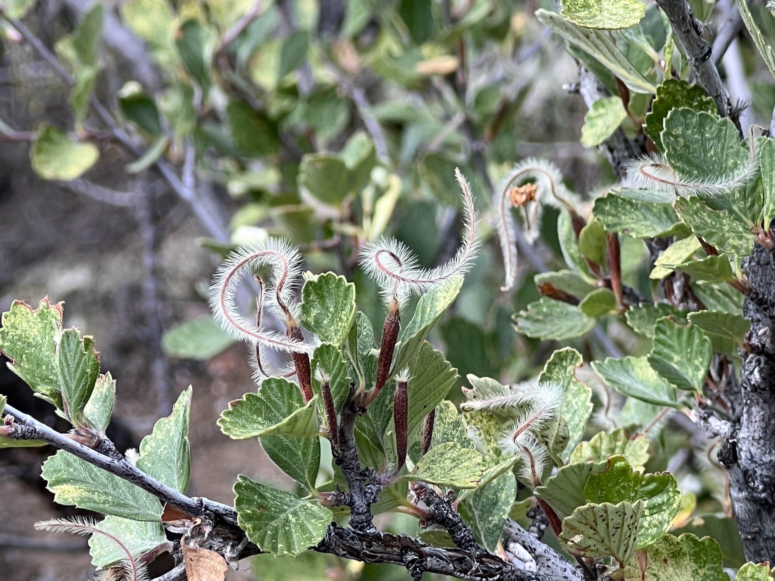
Mountain Mahogany (Cercocarpus montanus) is an evergreen shrub found in dry, rocky environments at mid to high elevations. It prefers south-facing slopes with shallow, well-drained soils, making it well-suited to the rugged terrain of Poudre Canyon. Rabbitbrush (Chrysothamnus spp.) is a drought-tolerant deciduous shrub that grows in various environments, from foothills to montane zones. It is often found on disturbed sites, rocky slopes, and open meadows, where it contributes to soil stabilization. Serviceberry (Amelanchier alnifolia) is a deciduous shrub that can be found in various habitats and elevations throughout Poudre Canyon. It prefers moist, well-drained soils and is often located near water sources, such as streams or seeps, making it a common sight in riparian areas. Sagebrush (Artemisia spp.) is a drought-tolerant evergreen shrub that is common in semi-arid environments common lower and intermediate elevations, where it provides important habitat and food resources for various wildlife species.
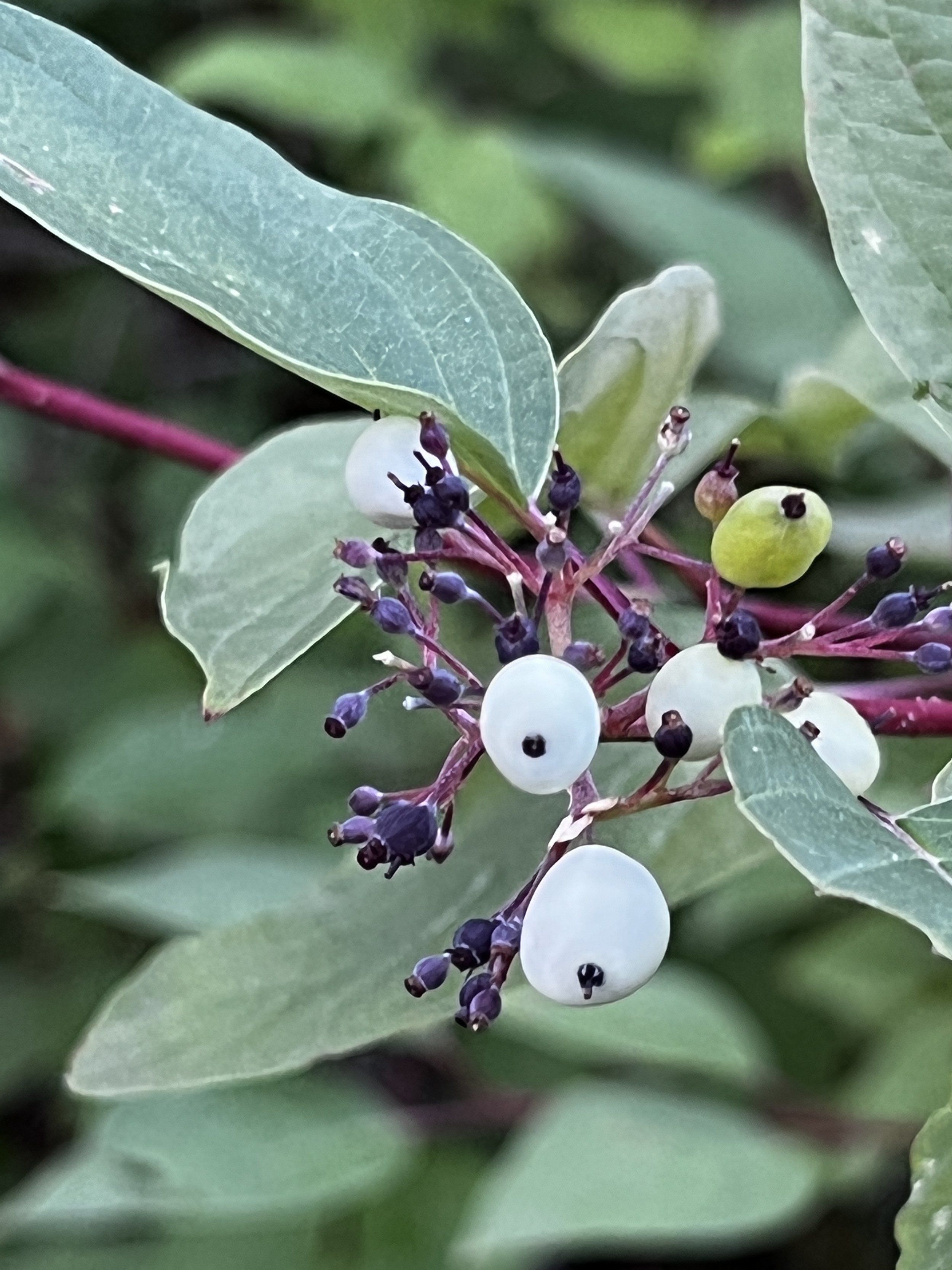
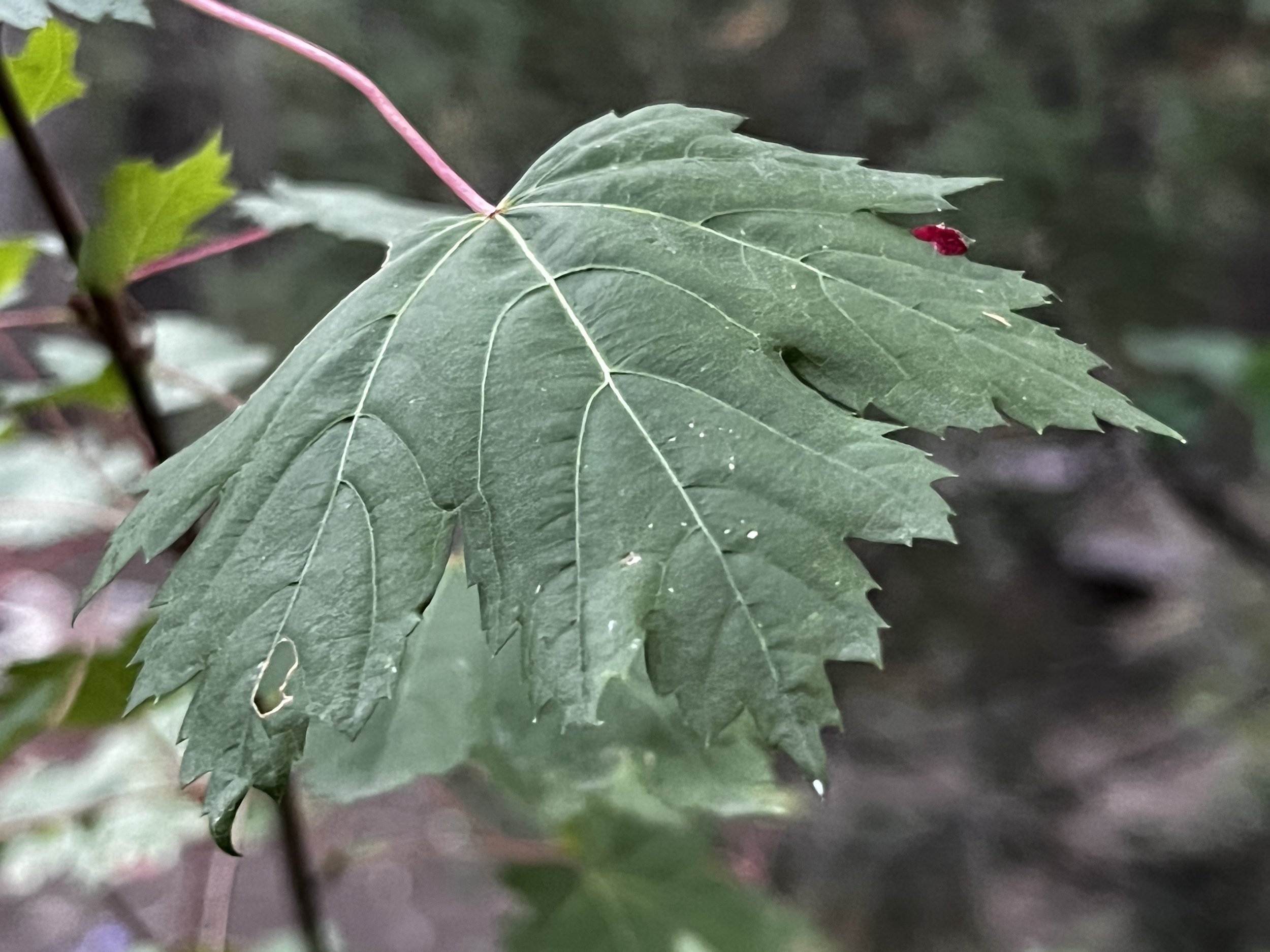
Willow (Salix spp.) is a deciduous shrub typically found along water sources, such as streams and rivers. In Poudre Canyon, it can be found at various elevations, from lower-gradient valley bottoms to higher elevations, where it plays a vital role in erosion control, wildlife habitat, and food supply. Chokecherry (Prunus virginiana) is a deciduous shrub or small tree that can be found in various habitats and elevations throughout Poudre Canyon. It prefers well-drained soils and is often found on hillsides, rocky slopes, and along water sources. Rocky Mountain Maple (Acer glabrum) is a deciduous shrub or small tree that prefers moist environments and can often be found along the river, throughout the Canyon. It grows at various elevations, providing habitat and food resources for a wide range of wildlife species.

| Common Name | Scientific Name | Ecology |
|---|---|---|
| Mountain Mahogany | Cercocarpus montanus | Evergreen shrub, found in dry, rocky environments at mid to high elevations, offers food and cover for wildlife, particularly birds. |
| Rabbitbrush | Chrysothamnus spp. | Drought-tolerant deciduous shrub, grows in various environments, provides food and cover for wildlife, contributes to soil stabilization. |
| Serviceberry | Amelanchier alnifolia | Deciduous shrub, found in various habitats and elevations, produces edible berries for wildlife, provides nesting sites for birds. |
| Sagebrush | Artemisia spp. | Drought-tolerant evergreen shrub, common in semi-arid environments, provides important habitat and food for various wildlife species. |
| Willow | Salix spp. | Deciduous shrub, typically found along water sources such as streams and rivers, offers valuable habitat, food, and erosion control for wildlife. |
| Chokecherry | Prunus virginiana | Deciduous shrub or small tree, found in various habitats at different elevations, provides food and habitat for birds and mammals. |
| Rocky Mountain Maple | Acer glabrum | Deciduous shrub or small tree, grows in moist environments and along water sources, offers habitat and food for various wildlife species. |

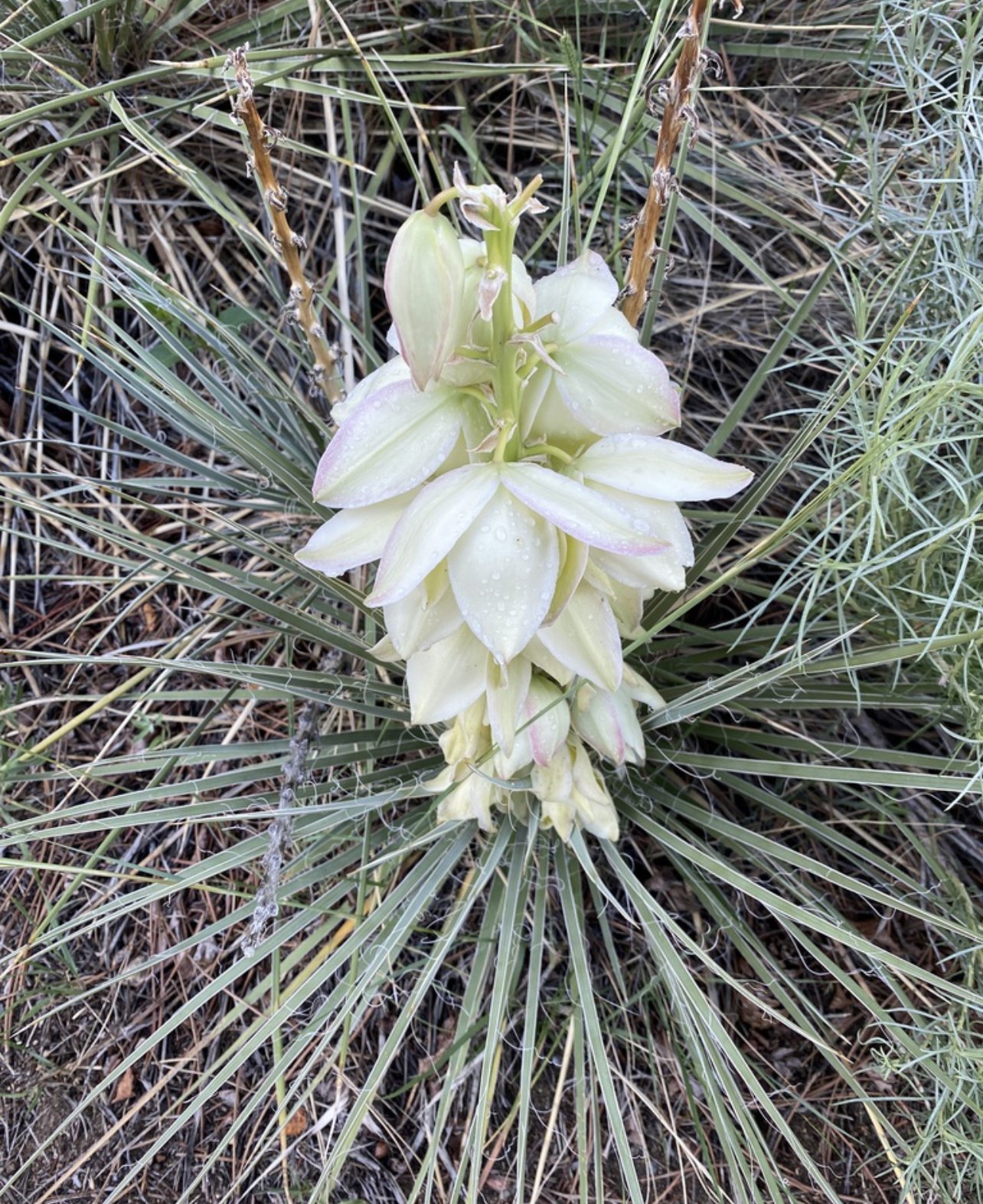
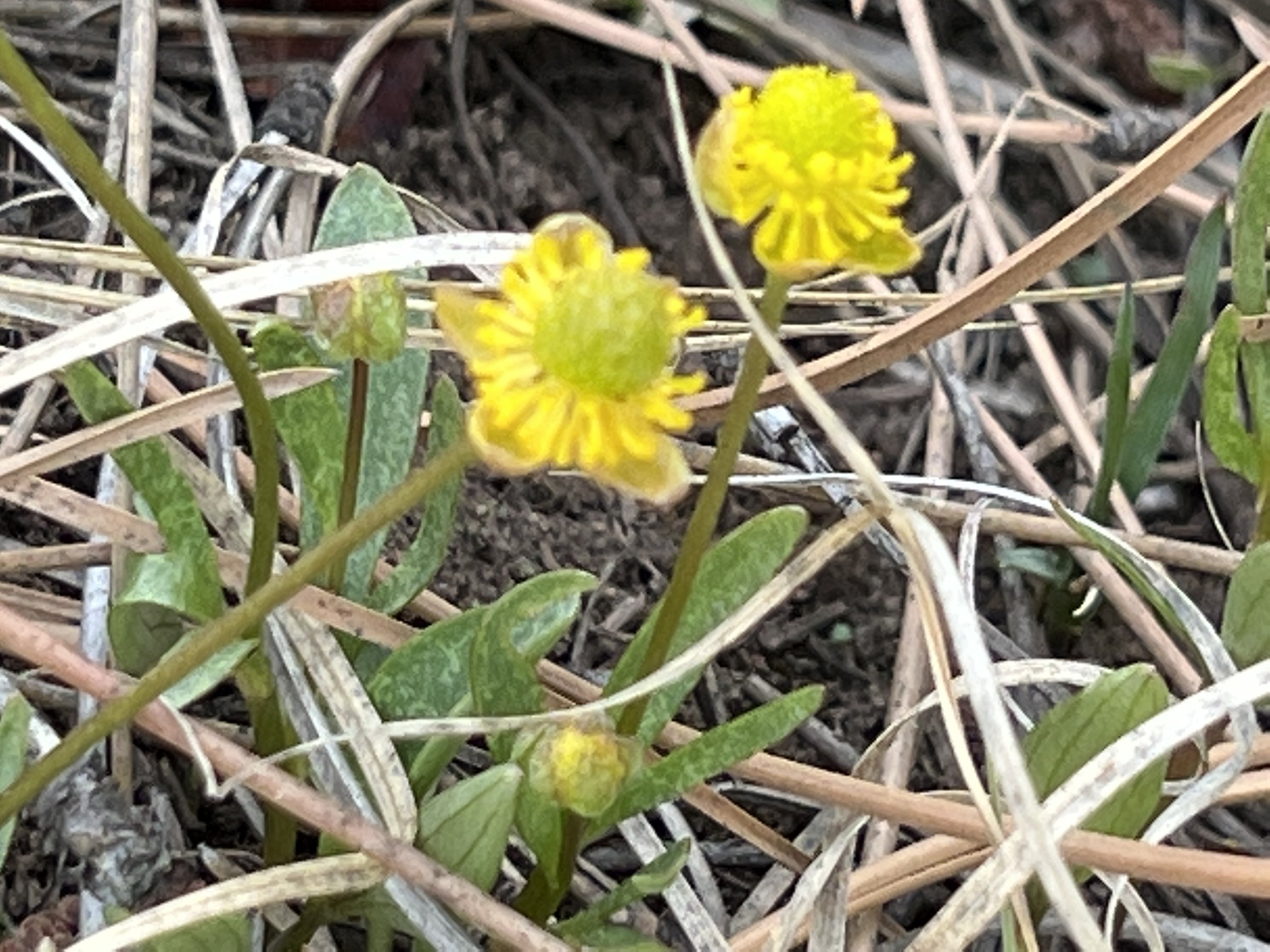
Wildflowers
Poudre Canyon boasts a diverse range of wildflowers spanning across grassland, montane, subalpine, and alpine life zones. The procession of blooming follows an elevation gradient, commencing from grasslands in late spring and culminating in the alpine zone during mid-summer.
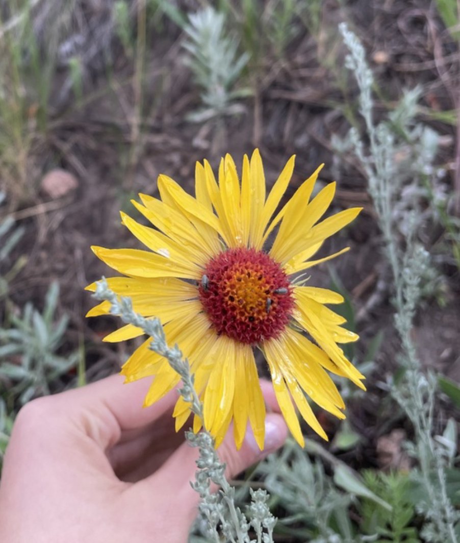
In the lower elevations, grassland wildflowers such as Plains Prickly Pear (Opuntia polyacantha), Blanket Flower (Gaillardia aristata), and Purple Coneflower (Echinacea angustifolia) flourish. Blooming in this zone typically begins in late spring and persists into mid-summer, with peak blooms in June.
As one ascends into the montane zone, wildflower diversity increases. Key species in this region include Colorado Columbine (Aquilegia coerulea), Indian Paintbrush (Castilleja spp.), and Wild Iris (Iris missouriensis). Montane wildflowers generally start blooming in late spring, peaking in July, and tapering off through August.
The subalpine zone, characterized by cooler temperatures and harsher conditions, hosts distinctive wildflowers like Alpine Sunflower (Tetraneuris grandiflora), Elephant's Head (Pedicularis groenlandica), and Marsh Marigold (Caltha leptosepala). Subalpine wildflowers tend to bloom from mid-summer to early fall, with peak blooms in July and August.
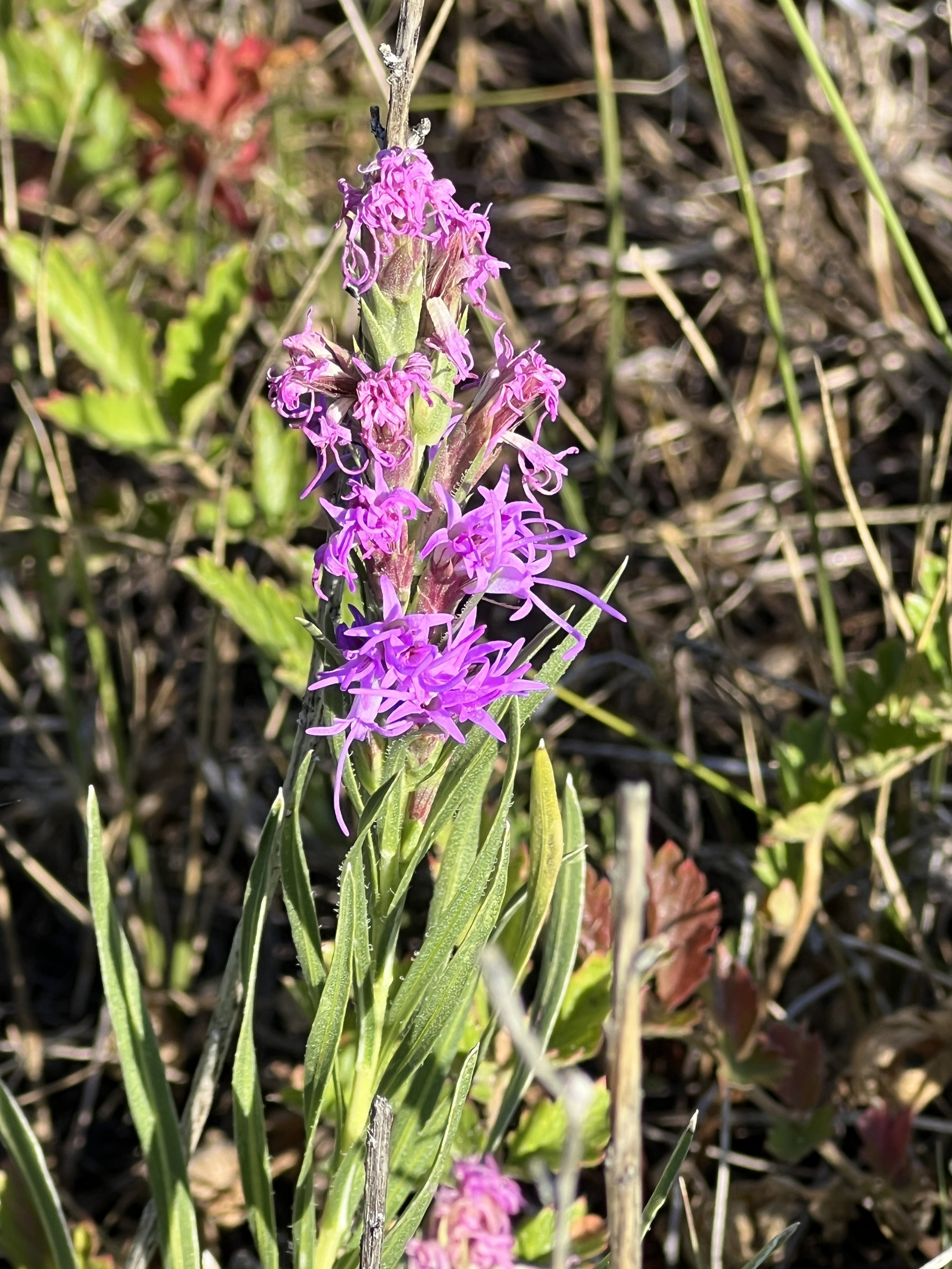
The highest elevation in Poudre Canyon, the alpine zone, is home to a unique set of wildflowers adapted to extreme conditions. These species include Alpine Forget-me-not (Myosotis alpestris), Sky Pilot (Polemonium viscosum), and Moss Campion (Silene acaulis). Alpine wildflowers typically bloom for a brief period from late June to early August, with peak blooms in July.
Fungi
Colorado is a treasure trove of edible mushrooms, offering a rich diversity of species for both culinary enthusiasts and avid foragers. This essay will explore some of the most popular edible mushrooms found in the state, their habitats, and the environmental factors that influence their growth. We will also provide some tips for successful foraging in Colorado's diverse terrain.
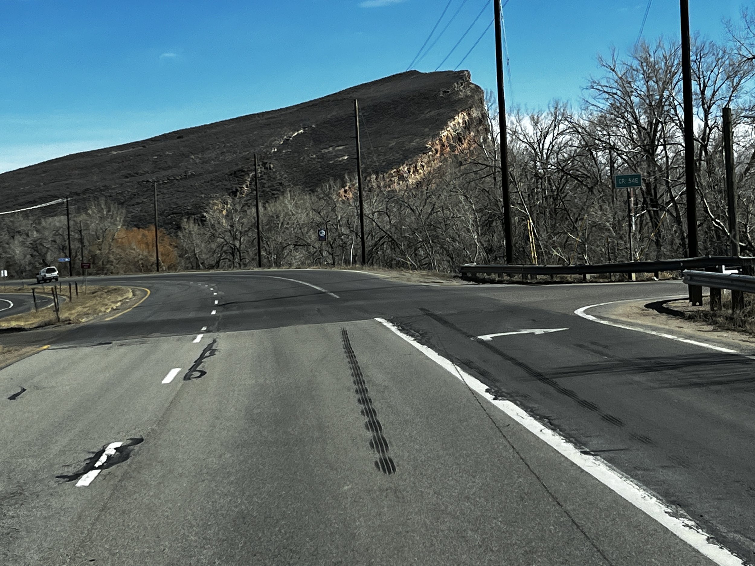
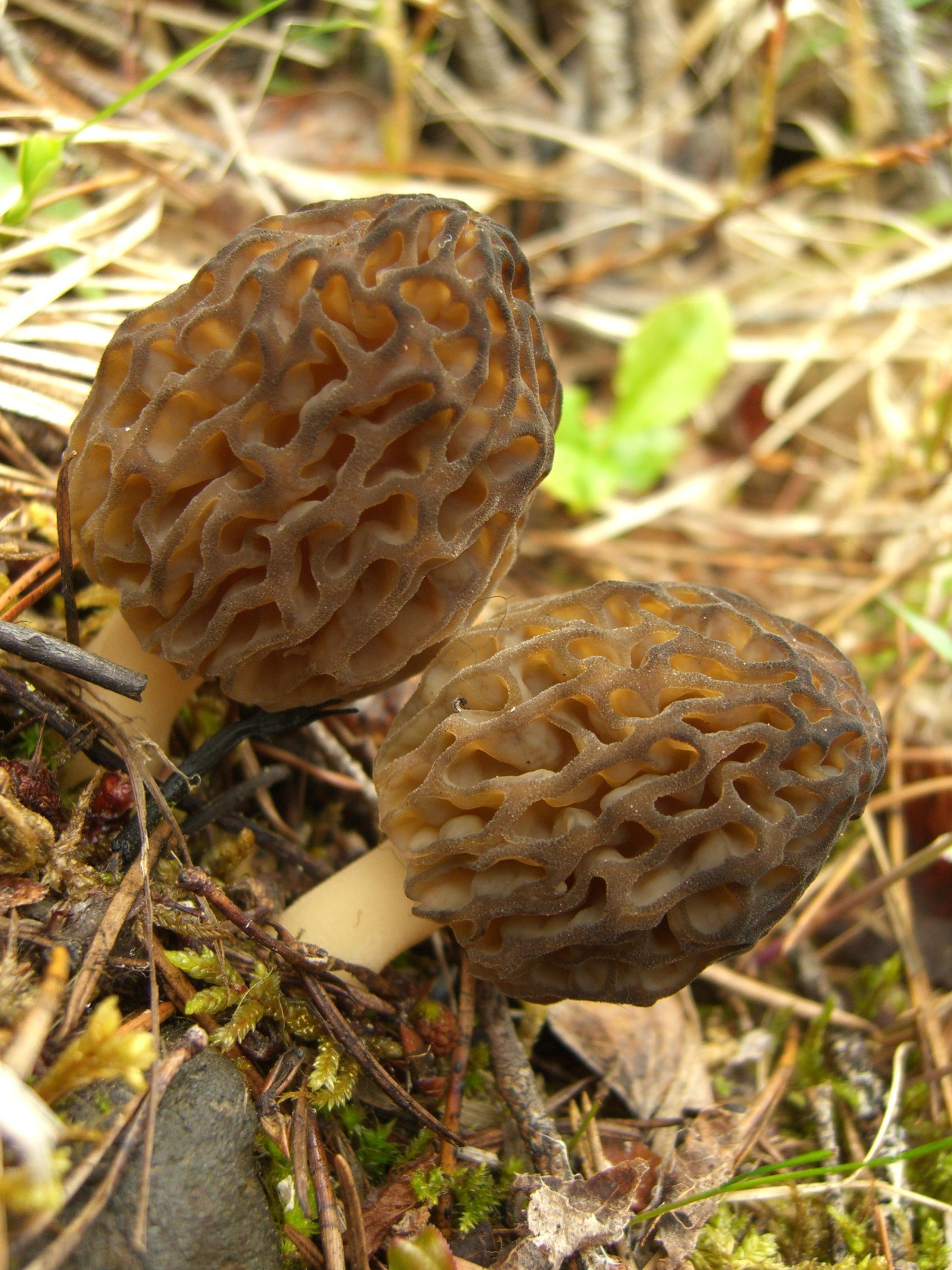
The state is home to a variety of notable edible mushrooms, including the Black Morel (Morchella angusticeps), King Bolete (Boletus rubriceps), Golden Chanterelle (Cantharellus cibarius), and Oyster Mushroom (Pleurotus populinus). The Cameron Peak Wildfire, a historically large wildfire that burned approximately 326 square miles, has created an environment rich in nutrients for these mushrooms. Adequate moisture combined with this nutrient-dense environment increases the likelihood of a flourishing mushroom population.
Morels, a highly sought-after mushroom, can be found in different habitats depending on the species. Yellow Morels prefer riparian areas with cottonwoods and grass, typically appearing in May at around 6000 feet in elevation. Black Morels, on the other hand, can be found in mixed conifer and aspen forests at elevations between 7000 and 9000 feet. Burn Morels, which emerge following forest fires, thrive in the first and second years after fires at elevations between 8000 and 11000 feet in mixed conifer forests.
Summer and fall mountain mushrooms, such as Porcini, Chanterelle, Hawk's Wing, Puffball, and Milky Cap, can be found from July to September in mixed conifer forests at elevations between 9000 and 11000 feet. Chanterelles are often elusive and rely on rainfall, while Boletes typically peak in August.
For those interested in foraging for mushrooms in Colorado, it is crucial to explore areas with elevations between 9000 and 11000 feet. Focusing on mixed conifer forests and their edges is essential, as well as seeking moist, mossy regions near openings and forest clearings.
Some of the most prized mushrooms in Colorado include the Chanterelle, which is characterized by its bright yellow-orange color and fruity, apricot aroma. They can be found in the high country above 10,500 feet in mixed conifer forest edges and clearings. The Hawk's Wing, easily identifiable by its teeth on the bottom of the cap, is abundant in the area and has a stout mushroom flavor when cooked well. Puff Balls, which can resemble poisonous mushrooms when young, require caution during collection. Porcini mushrooms, found between elevations of 10,500 and 11,200 feet, require specific weather conditions to thrive and are considered choice edibles due to their firm, earthy, and nutty flavor.
By understanding the environmental factors that influence their growth and adopting a strategic approach to foraging, enthusiasts can enjoy the rich diversity of mushrooms that Colorado has to offer.
Lichens
Lichens are a prominent element of the Poudre Canyon landscape, despite being diminutive in size. Lichens are composite organisms that arise from a symbiotic relationship between fungi and photosynthetic partners, typically either green algae or cyanobacteria. The fungal component, known as the mycobiont, forms the majority of the lichen's structure, providing a protective environment for its photosynthetic partner, called the photobiont. The photobiont, in turn, supplies the mycobiont with essential nutrients, such as carbohydrates, through photosynthesis. This unique alliance allows lichens to thrive in diverse environments, including some of the most inhospitable habitats on Earth.
Lichens exhibit multiple modes of reproduction, ranging from sexual to asexual. The fungal partner typically reproduces sexually through the production of spores, which are released into the environment to initiate new lichen growth. However, lichens primarily propagate through asexual means, such as fragmentation or the formation of specialized structures called soredia and isidia, which contain both fungal and algal components.
Lichens possess remarkable physiological adaptations that enable them to tolerate extreme environmental conditions. They can endure desiccation, freezing, and high levels of UV radiation, rapidly reviving their metabolic processes when favorable conditions return. These adaptations are particularly advantageous for the lichens found in the Poudre Canyon, which often experience fluctuating temperatures, high altitude, and low humidity.
Common Lichen Species in the Canyon include:
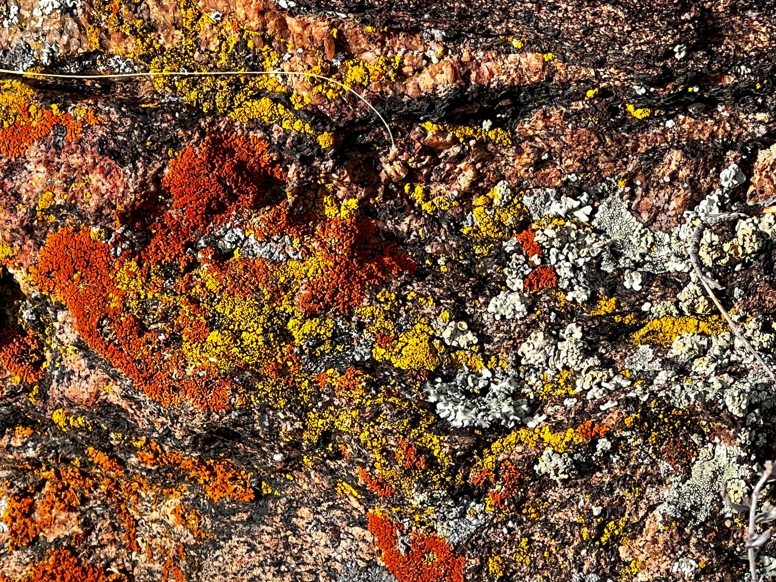
Cup lichens (Cladonia spp.) are common in the Front Range and can be recognized by their distinct, cup-shaped growth form. These lichens play a vital role in soil stabilization and nutrient cycling in the region's ecosystems.
The map lichen (Rhizocarpon geographicum) is characterized by its yellow-green, map-like patterns. It thrives on rock surfaces where it contributes to the weathering of rock.
Sunburst lichens (Xanthoria spp.) are brightly colored, orange to yellow lichens often found on exposed rock surfaces and tree bark.
Beard lichens (Usnea spp.) are filamentous and commonly found draping tree branches.
Riparian and Wetland Ecosystems
There are several factors that influence the form of a river. Some of the most important factors include the type and shape of the river's channel, the gradient of the land, the amount and type of sediment carried by the river, and the climate and weather patterns in the river's watershed. The shape and type of a river's channel can have a significant impact on its form. For example, a river that flows through a narrow, steep-sided valley will tend to have a more turbulent, fast-flowing form than a river that flows through a wide, flat plain. The gradient of the land, or the slope of the land surface, also plays a role in the form of a river.
The amount and type of sediment carried by a river can also influence its form. Rivers that carry large amounts of sediment tend to have a more meandering form, with a wide, shallow channel and many curves and bends. In contrast, rivers that carry little sediment tend to have a more straight and narrow form. Finally, the climate and weather patterns in a river's watershed can affect its form. For example, rivers in areas with high levels of precipitation will tend to have a more intense and rapid flow than rivers in dry areas.
Riparian woodland and shrublands dominate the Poudre River channel corridor in lower Montane and Foothills zones. Similar systems are found throughout the Rocky Mountain region within elevations of 5,000 to 9,000 ft. Seasonal and episodic flooding drives the ecosystem, maintaining diverse plant associations. Vegetation consists of tree-dominated communities with a varied shrub component, varying with elevation, stream gradient, floodplain width, and flooding events. Dominant trees may include cottonwoods, willows, and various conifers, while dominant shrubs may include maples, alders, and dogwoods. The hydrology of this system is primarily snowmelt-driven, with annual and episodic flooding. The riparian ecosystem is differentiated from other systems by elevation, vegetation, and hydrology. At higher elevations, riparian ecosystems appear as either a narrow band of shrubs along steep, V-shaped canyon streambanks or as extensive shrub stands on alluvial terraces in gentle valley bottoms. Dominant shrubs typically include willow (Salix spp.), alder (Alnus spp.), and birch (Betula spp.).
While comprising a small porportion of landscape area, a variety of wetland can be found in the Poudre Canyon. The specific types vary with elevation and landscape position and include wet meadows, marshes, and fens.
Wet meadows are herbaceous wetlands with mineral soils and fluctuating water tables and found at elevations between ~7,000-13,000 feet across the Rocky region. They are characterized by low-velocity surface and subsurface flows, and can be found in various landscapes such as large open meadows, toeslope seeps, or bordering ponds, lakes, and streams. They’re more abundant at higher elevations Alpine wet meadows typically occupy small depressions below late-melting snow patches or snowbeds, often surrounded by dwarf shrublands dominated by willows. Wet meadow soils exhibit hydric characteristics like high organic content while vegetation is often dominated by graminoids, with substantial forb cover at higher elevations. Hydrologic regime is crucial in defining wet meadows, which have seasonally saturated soil but lack the perennially high water tables found in fens or the large fluctuations in water level typical of marshes. Wet meadows can be found in riparian corridors and floodplains but are not influenced by high-velocity surface flows, scouring, or sediment deposition that characterize active riparian zones.
Beaver
The beaver (Castor canadensis) is a large, semiaquatic rodent that plays an important role in the ecology of freshwater ecosystems across North America. Beavers are well adapted to aquatic life, with webbed hind feet, a flattened, paddle-like tail, and waterproof fur. They are primarily herbivorous, feeding on a variety of aquatic and terrestrial plants, including willow, aspen, cottonwood, and alder. Beavers are social animals that live in family groups consisting of a monogamous breeding pair and their offspring. They build complex dams and lodges out of sticks, mud, and other materials to create habitat for themselves and to manipulate water flow in their environment. They prefer slow-moving, shallow water with abundant vegetation for food and building materials, and they are particularly adept at creating their own habitat through the construction of dams and lodges.
Beavers play a key role in the reproduction of willow, a common riparian plant in the Front Range of Colorado. By selectively cutting and eating young willow shoots, beavers promote the growth of lateral branches and increase the number of shoots, which in turn increases the plant's overall biomass and reproductive potential. In this way, beavers help to maintain the health and diversity of riparian plant communities.
Beavers are considered ecosystem engineers, as they have a significant impact on the physical structure of freshwater ecosystems. By building dams and lodges, they create habitat for themselves and for a variety of other plants and animals, including fish, amphibians, and insects. They also influence water flow and nutrient cycling in their environment. Asexual reproduction of willows can occur in beaver dams. Over time, these stems can develop into new plants, creating dense thickets of willows arranged linearly along the dam.
Wildlife
The Poudre Canyon in Colorado is home to a diverse range of wildlife species that thrive in its unique ecosystem. This region is characterized by a mixture of mountainous terrain, dense forests, grasslands, and the Cache la Poudre River. The canyon provides an ideal habitat for various mammals, birds, reptiles, and amphibians. Here, we will discuss some of the most common wildlife species found in the Poudre Canyon.
Large Mammals
Rocky Mountain Elk (Cervus canadensis nelsoni): This majestic mammal is one of the largest members of the deer family. The Rocky Mountain Elk is an iconic symbol of the American West, known for its impressive antlers and distinctive bugle call. These animals typically inhabit forests, meadows, and alpine tundras. They are primarily grazers, feeding on grasses, forbs, and shrubs. The elk's social structure consists of large herds, with males competing for dominance during the mating season.
Mule Deer (Odocoileus hemionus): The Mule Deer is another common species found in the Poudre Canyon. They are named after their large, mule-like ears, which provide excellent hearing. Mule deer are highly adaptable and can be found in a wide range of habitats, from forests and grasslands to deserts. They are primarily browsers, feeding on a variety of plant species. Mule deer are known for their unique bounding gait, called stotting, which allows them to quickly navigate through rough terrain.
Black Bear (Ursus americanus): The Black Bear is the smallest and most common bear species in North America. These omnivores are highly adaptable and can be found in a variety of habitats, including forests, swamps, and grasslands. Black bears have a diverse diet, consuming berries, nuts, insects, fish, and small mammals. Despite their name, their fur can range in color from black to brown or even blonde.
Mountain Lion (Puma concolor): Also known as the cougar, the Mountain Lion is a skilled predator and the largest wild cat in North America. Mountain lions are solitary animals with large territories, often preferring habitats with dense cover and rugged terrain. They are ambush predators, primarily preying on deer, but they will also consume smaller mammals, birds, and even reptiles. Mountain lions are known for their incredible agility and strength, capable of leaping up to 40 feet horizontally and 18 feet vertically.
Bighorn Sheep (Ovis canadensis): These impressive animals are named for their large, curved horns, which are used in head-butting battles for dominance during the mating season. Bighorn sheep are well-adapted to the steep, rocky terrain of the Poudre Canyon, with their specialized hooves providing excellent grip and balance. They primarily graze on grasses, shrubs, and forbs. Bighorn sheep are a symbol of the rugged beauty of the American West and are often sought after by wildlife enthusiasts and photographers.
| Common Name | Scientific Name |
|---|---|
| Rocky Mountain Elk | Cervus canadensis nelsoni |
| Mule Deer | Odocoileus hemionus |
| Black Bear | Ursus americanus |
| Mountain Lion | Puma concolor |
| Bighorn Sheep | Ovis canadensis |
| Coyote | Canis latrans |
Small Mammals
The Poudre Canyon in Colorado is home to a diverse array of small mammal species, thriving in the region's varied habitats such as coniferous forests, meadows, and rocky slopes. Some common small mammals in the area include the American Pika, Yellow-bellied Marmot, Abert's Squirrel, Least Chipmunk, Golden-mantled Ground Squirrel, and Uinta Ground Squirrel. These species play essential roles in the canyon's ecosystem, contributing to seed dispersal, soil aeration, and serving as prey for larger predators. The small mammals of Poudre Canyon showcase the area's rich biodiversity and the importance of maintaining and preserving their habitats.
| Common Name | Scientific Name | Ecology Summary |
|---|---|---|
| American Pika | Ochotona princeps | Typically found in talus slopes and rocky areas above the tree line; they feed on various vegetation such as grasses, forbs, and shrubs. |
| Yellow-bellied Marmot | Marmota flaviventris | Primarily found in alpine and subalpine habitats, often residing in rocky areas or meadows; they are herbivores that consume grasses, flowers, and occasionally insects. |
| Abert's Squirrel | Sciurus aberti | Found mainly in ponderosa pine forests, where they feed primarily on pine seeds, bark, and buds, as well as fungi and other plant material. |
| Least Chipmunk | Neotamias minimus | Often found in coniferous forests, shrublands, and meadows, these omnivores feed on seeds, fruits, fungi, insects, and bird eggs. |
| Golden-mantled Ground Squirrel | Callospermophilus lateralis | Inhabit coniferous forests and meadows, feeding on a varied diet of seeds, fruits, flowers, insects, and occasionally small vertebrates. |
| Uinta Ground Squirrel | Urocitellus armatus | Found in sagebrush and grassland habitats, they feed on grasses, forbs, and seeds, and are known for their burrowing behavior. |
Birds
Poudre Canyon is home to a wide variety of bird species. The bird populations can be categorized based on the habitats they occupy within the canyon. Grassland and shrubland habitats at lower elevations in the Canyon support various ground-nesting birds, raptors, and some songbirds. The Canyon has various forest types, including coniferous, mixed, and deciduous forests supporting woodpeckers, owls, hawks, and a variety of songbirds. Species such as the Steller's Jay and Pine Grosbeak are common in these habitats. Higher elevations in Canyon feature alpine and subalpine habitats characterized and supports birds adapted to the harsher climatic conditions. In riparian and wetland habitats, characterized by the presence of rivers, streams, and marshy areas, waterfowl, wading birds, and a variety of songbirds can be observed. Cliffs and rock outcrops are a unique habitat important to a variety of different birds. Bird populations in Poudre Canyon can vary seasonally, with some species being migratory and others being year-round residents. The diverse habitats within the canyon provide a rich environment for birdwatching.
Hummingbirds
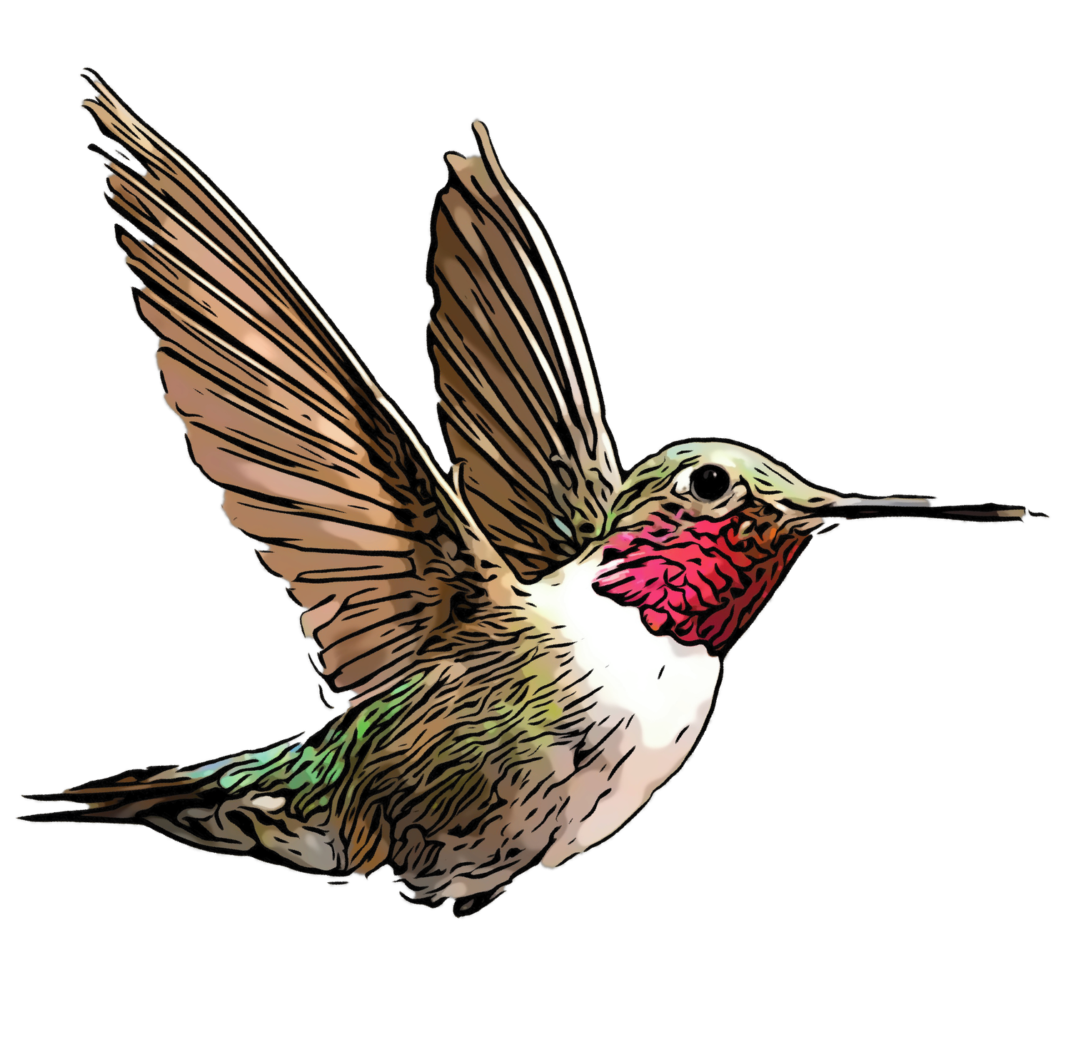
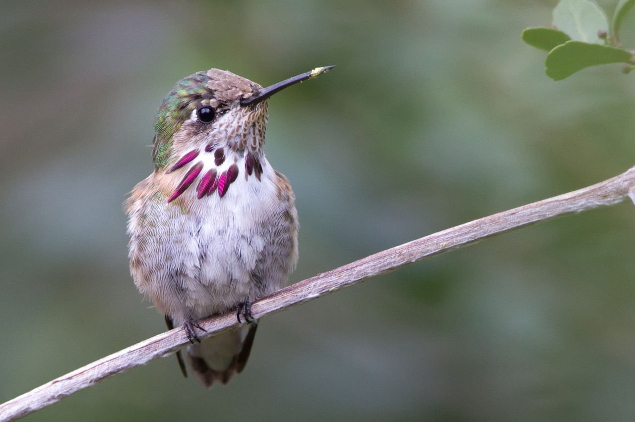
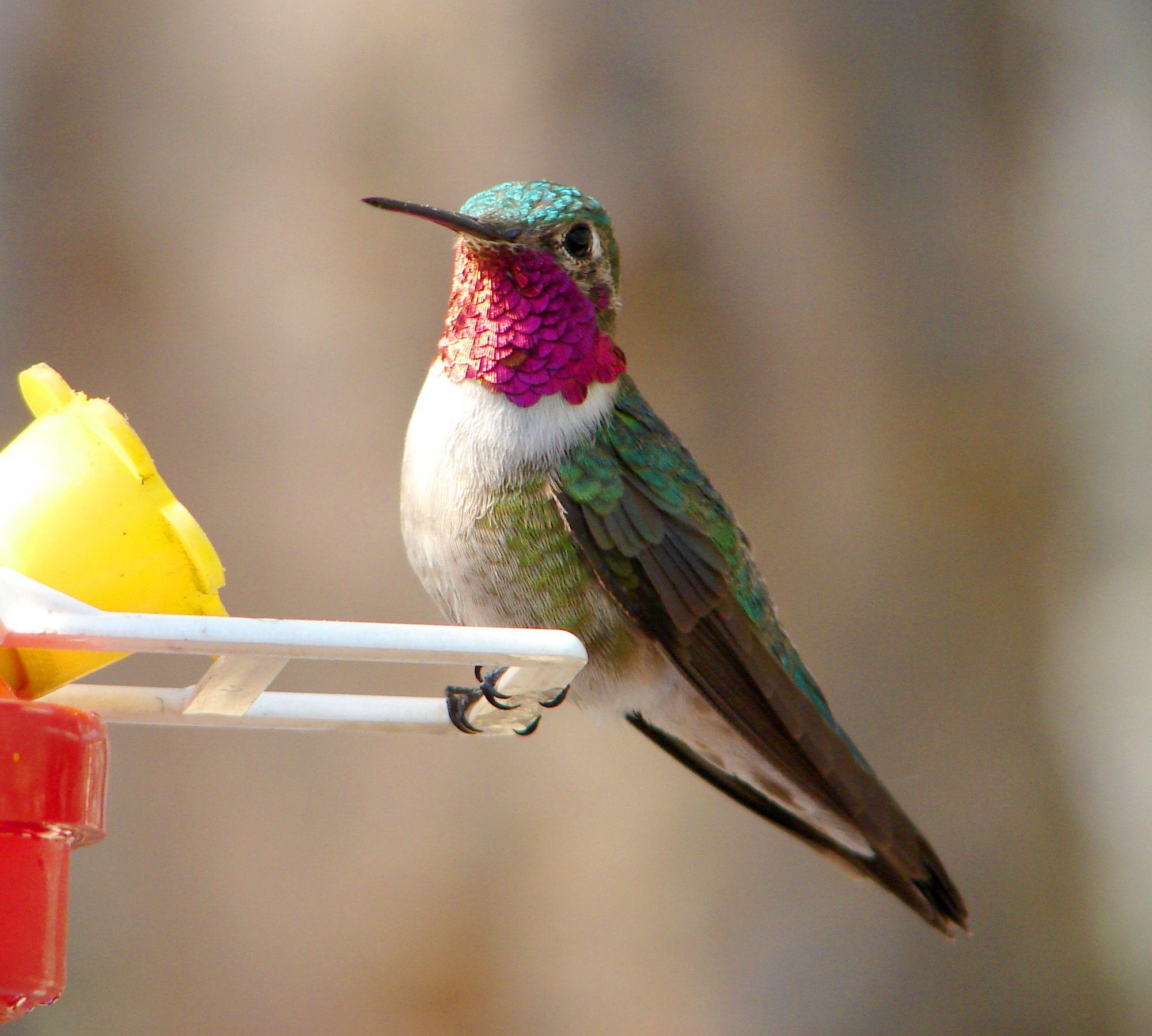
Hummingbirds are one of the most charismatic seasonal denizens of the Poudre Canyon. Two of the most prevalent hummingbird species observed in the Poudre Canyon are the Broad-tailed Hummingbird (Selasphorus platycercus) and the Rufous Hummingbird (Selasphorus rufus). These species flourish in a range of habitats, including montane forests, riparian woodlands, and meadows abundant with wildflowers.
The Broad-tailed Hummingbird, distinguishable by its iridescent green plumage and the male's rose-colored gorget, typically arrives in Colorado between late April and early May. They can be found at elevations from 6,000 to 12,000 feet. Primarily nectarivorous, Broad-tailed Hummingbirds are drawn to tubular flowers, such as red columbine, Indian paintbrush, and trumpet-shaped penstemons. They also consume small insects and spiders, which provide essential protein, particularly during the breeding season.
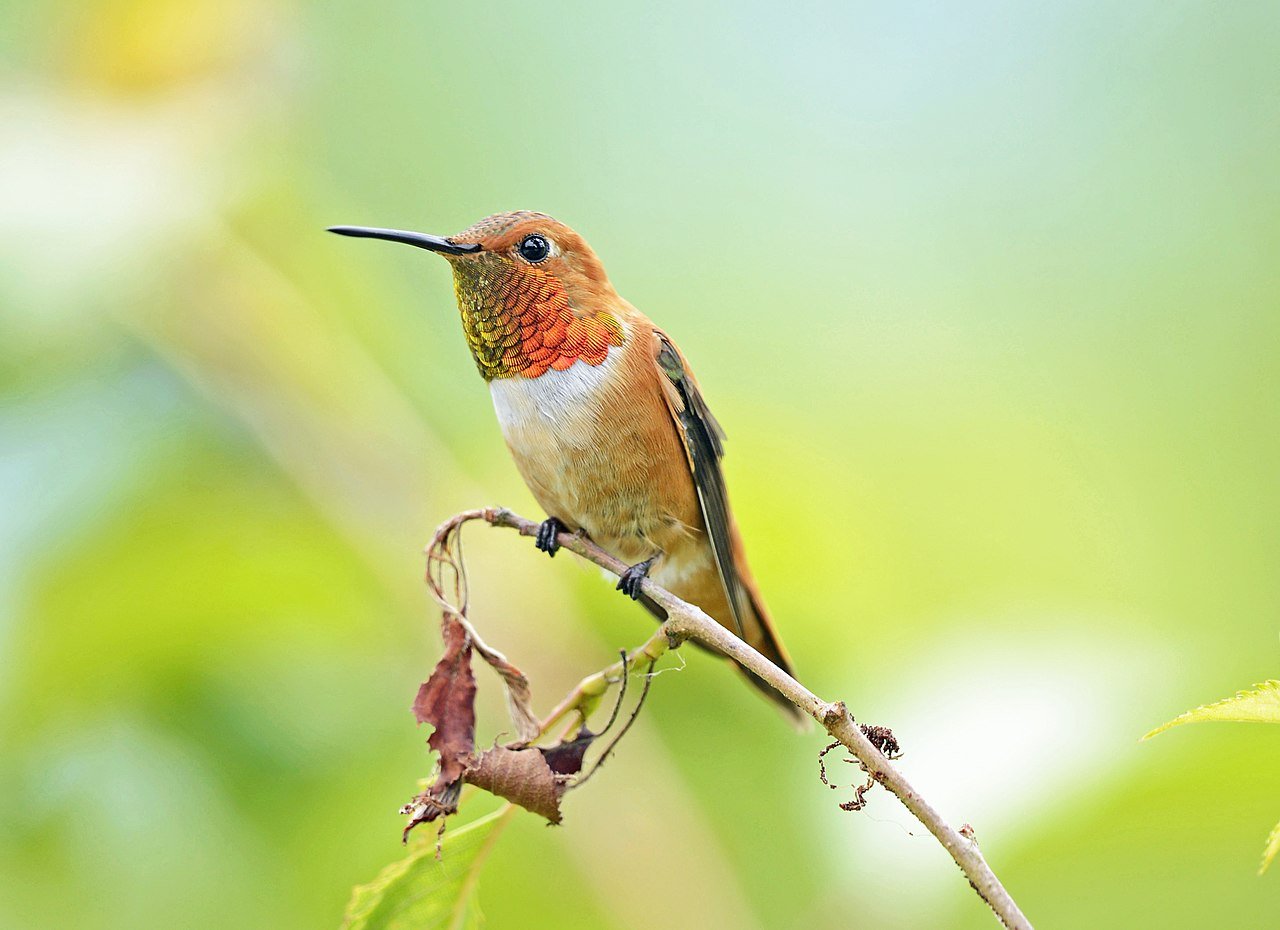
The Rufous Hummingbird, characterized by its bright orange or reddish-brown plumage and the male's vibrant red gorget, is renowned for its extensive migratory patterns, spanning from Mexico to Alaska and back annually. Rufous Hummingbirds visit Poudre Canyon during their northward migration.
Less common but a treat to observe are Calliope Hummingbirds. Characterized by their diminutive size, iridescent green plumage, and the striking magenta gorget displayed by males, they inhabit a range of habitats, including montane forests, meadows, and riparian zones, typically at elevations of 5,000 to 11,000 feet. Their breeding range spans from the western United States to southwestern Canada, with winter migration leading them to central Mexico. Calliope Hummingbirds primarily feed on nectar from tubular flowers, such as red columbine, Indian paintbrush, and various penstemons. They display a preference for native wildflowers, and their long, slender bills are well-adapted for accessing nectar from these flowers. Additionally, they consume small insects and spiders, which provide essential protein and other nutrients, particularly during breeding and migration periods.
| Common Name | Scientific Name | Key Identifying Characteristics |
|---|---|---|
| Rufous Hummingbird | Selasphorus rufus | Small, bright orange, some males have an iridescent red throat |
| Broad-tailed Hummingbird | Selasphorus platycercus | Green upperparts, white underparts, males have iridescent rose-red throat |
| Black-chinned Hummingbird | Archilochus alexandri | Green upperparts, white underparts, adult male has a black throat with a purple band |
| Calliope Hummingbird | Selasphorus calliope | Smallest North American hummingbird, green upperparts, white underparts, males have a magenta gorget |
The Poudre River
The Cache la Poudre River in Northern Colorado, a snowmelt-dominated system, serves as a vital water source for agricultural, municipal, and industrial users in the region. The river has been used as a water source since settlers arrived in the area during the 1850s and is managed through an extensive network of diversions and impoundments. It is the only river in Colorado classified as both a Wild and Scenic River and a National Heritage River.
The Cache la Poudre watershed, located in Northern Colorado and a small portion of Southeastern Wyoming, covers an area of 4824 km2 and varies in elevation from 1406 to 4125 m. Land cover in the basin includes tundra at high elevations, subalpine and montane coniferous forests at middle elevations, and grasslands at low elevations. Precipitation generally increases and temperature decreases with elevation, contributing to significant climate variability throughout the basin.
The mountain snowpack in Western North America plays a crucial role in the hydrologic cycle by storing winter precipitation, which is then released during spring and summer when water demands for economic, environmental, and recreational purposes are at their peak. Snowmelt is an essential component and predictor of streamflow, accounting for 50-80% of the total annual runoff in snowmelt-dominated basins. Snow storage constitutes the largest water storage component for most of the Western U.S.
Stream Flow
The Cache la Poudre River's flow is modified by an extensive network of diversions and impoundments. These affect the timing and magnitude of discharge. Diversions remove water from the river for consumption throughout the year, while foreign water is brought into the Cache la Poudre drainage network from outside the basin, increasing flows beyond natural conditions. The main channel of the Cache la Poudre River has never been impounded; however, numerous tributary impoundments and off-channel reservoirs have been constructed to store snowmelt runoff. Water diversions into and releases from these reservoirs alter the flow regime. Diversions have the most significant impact on discharge at the Canyon Mouth at both annual and seasonal time scales. Reservoir operations generally reduce flow during hydrograph rise and supplemented flow during hydrograph recession.
Like all rivers in the region, humans have had a range of direct and indirect impacts on riparian ecosystems. Beaver trapping, primarily from 1815-1840, affected all Front Range rivers, leading to increased flow velocity, stream bed and bank erosion, and decreased sediment storage, channel stability, and diversity. Railroad tie drives occurred from the 1860s-1890s in the Poudre River. This practice modified channels, removed obstructions and wood, and led to scouring effects. Timber harvest destabilized hill slopes and increased sediment yields while transportation corridors have also increased sedimentation and reduced floodplain and riparian corridors except for the South Fork of the Poudre River. Human development has increased water and sediment yield and introduced contaminants into rivers, while constraining channel and floodplain space. Grazing has been ongoing since 1860, affecting limited reaches along most rivers, leading to riparian vegetation removal, bank erosion, increased nutrient input, and reduced aquatic and riparian habitat.
The Canyon through the Seasons
Spring
In early spring, lower elevations feature flowers such as pasqueflower (Pulsatilla patens, Ranunculaceae) and sand lily (Leucocrinum montanum, Asparagaceae). Late spring to early summer sees the foothills flourishing with species like western wallflower (Erysimum capitatum, Brassicaceae) and blue flax (Linum lewisii, Linaceae).
Summer
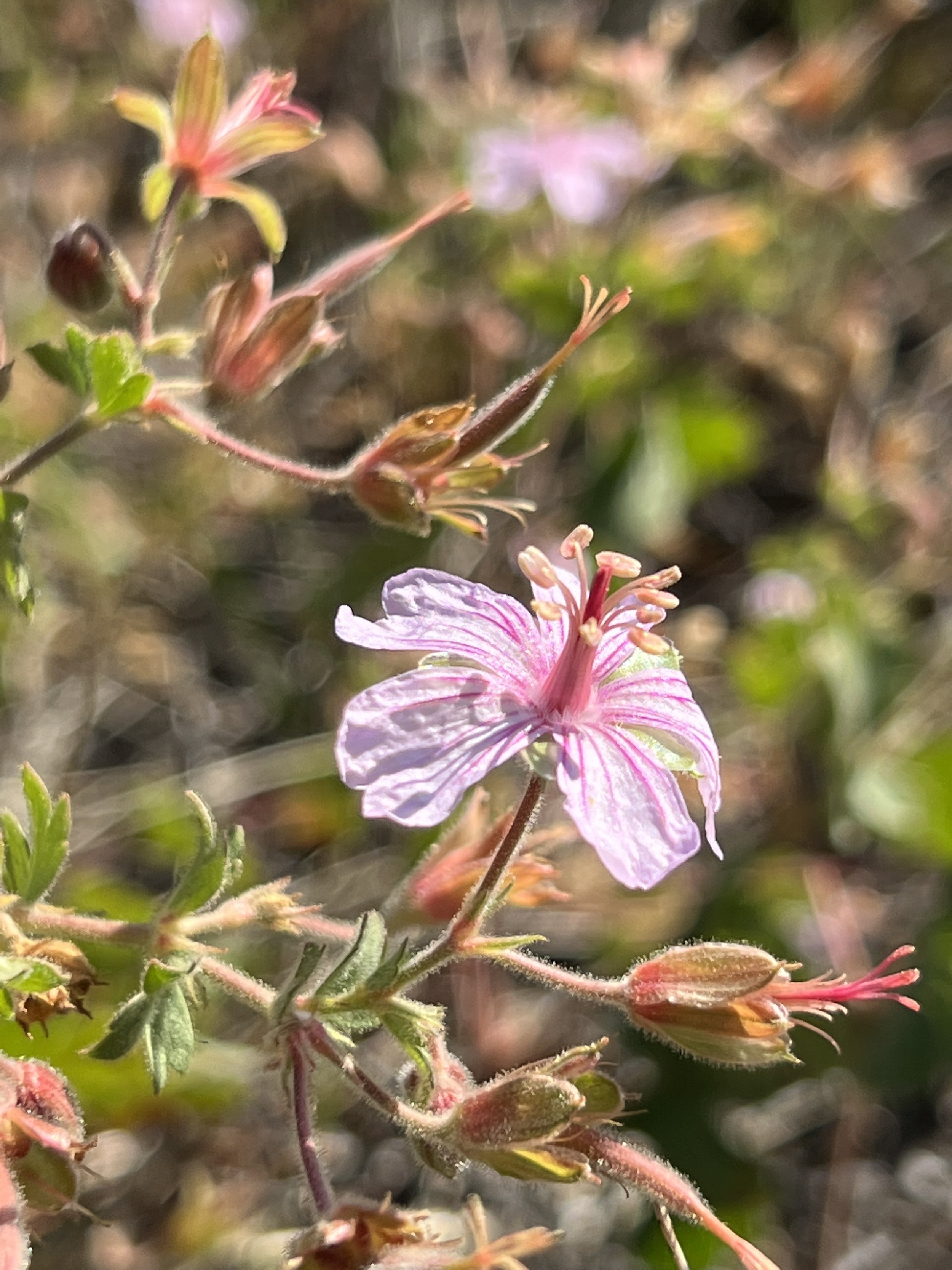
Mid-summer in the montane zone brings wildflowers like wild geranium (Geranium maculatum, Geraniaceae), columbine (Aquilegia coerulea, Ranunculaceae), and lupine (Lupinus spp., Fabaceae). Late summer witnesses subalpine blooms, including alpine sunflower (Tetraneuris grandiflora, Asteraceae), fireweed (Chamerion angustifolium, Onagraceae), and fairy slipper orchid (Calypso bulbosa, Orchidaceae).
Alpine wildflowers, with a short growing season, emerge in late summer, showcasing species such as sky pilot (Polemonium viscosum, Polemoniaceae), old-man-of-the-mountain (Hymenoxys grandiflora, Asteraceae), and alpine forget-me-not (Myosotis alpestris, Boraginaceae).
Fall
The patina on river rocks, visible at low flow, is caused by a combination of factors. Chemical weathering occurs as minerals in the rocks react with water and chemicals, forming new minerals on the surface. Physical weathering, through constant tumbling and abrasion, can make rock surfaces smooth and polished. Biological activity, such as bacteria, algae, and fungi, can grow on rock surfaces, contributing to the patina through biofilms. Mineral deposits from dissolved minerals in the water can accumulate on rock surfaces, while oxidation, particularly of iron, can produce rust-like colors. The specific appearance of the patina depends on the minerals in the rocks, water chemistry, and local environmental conditions.
Winter
Winter snowpack undergoes continuous metamorphosis due to factors such as weather, wind, melting, and soil temperature, resulting in a stratified structure with layers of varying hardness, cohesion, and strength. Equi-temperature metamorphosis occurs when the snowpack is near isothermal, leading to denser, harder snow with eroding or fragmented crystals. Melt-freeze metamorphosis, characterized by periodic melting and freezing, alternately weakens and strengthens the snowpack. Temperature-gradient metamorphosis occurs when temperature within the snowpack fluctuates dramatically, producing large, loose crystals resembling cubes.
These processes affect avalanche risk by creating unstable layers within the snowpack. Weak layers can collapse under the weight of a cohesive slab of snow above, triggering avalanches. It is critical to research avalanche conditions before skiing or snowshoeing to ensure safety and avoid potential hazards.